Route Finder

City Hall to Farrer Road Route

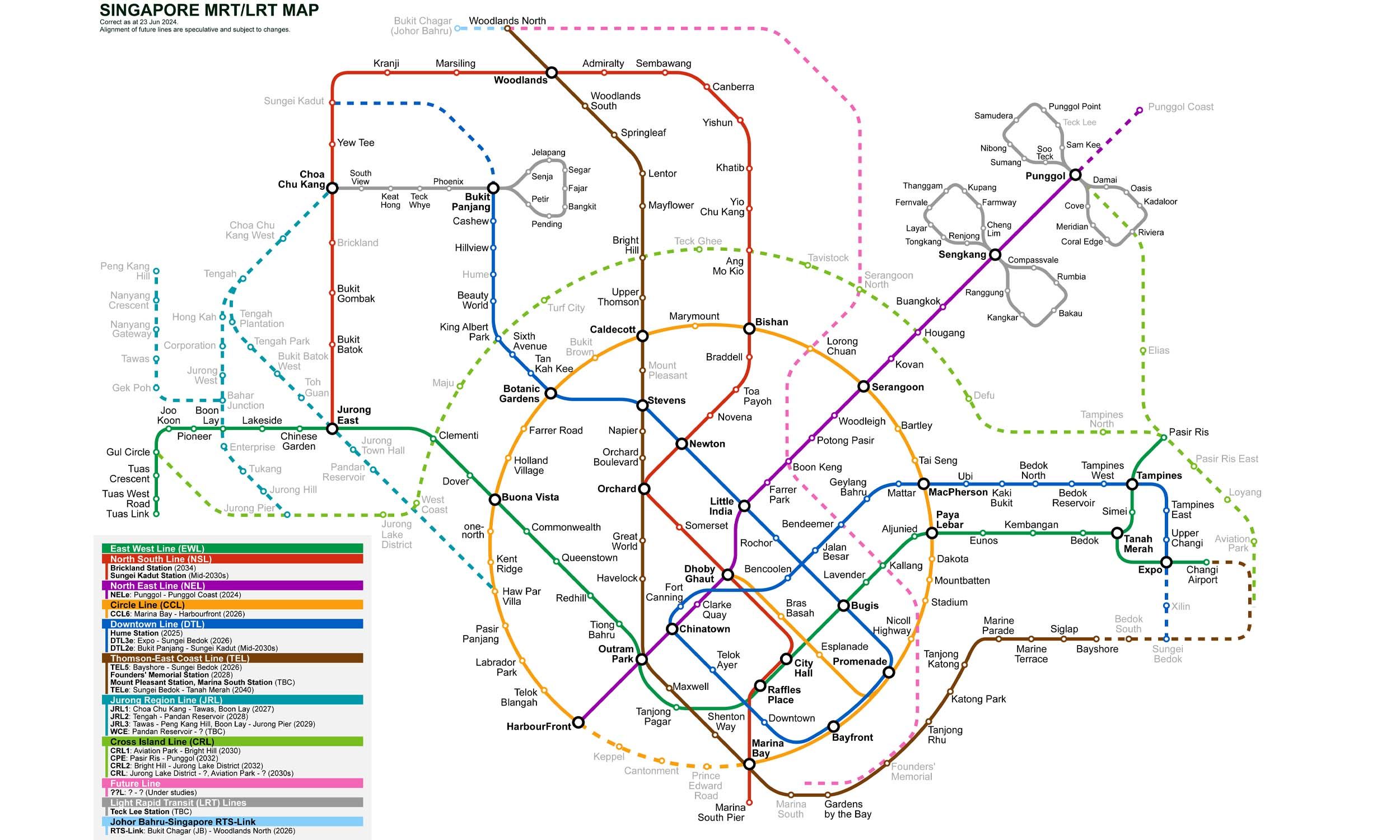
9 stations3 interchanges8.2 km~16 min
Board North–South Line towards Marina South Pier
Change to Thomson–East Coast Line towards Bayshore
Change to Downtown Line towards Expo
Change to Circle Line towards HarbourFront
Origin

City Hall Singapore

No gate information available.

Destination

Farrer Road Singapore

No gate information available.

City Hall to Farrer Road — Frequently Asked Questions

There are 9 stations on the route from City Hall to Farrer Road, including the origin and destination.

You need to make 3 interchanges to travel from City Hall to Farrer Road, using North–South Line and Thomson–East Coast Line and Downtown Line and Circle Line.

The distance from City Hall to Farrer Road is approximately 8.2 km by MRT.

The estimated journey time from City Hall to Farrer Road is approximately 16 minutes.

You can travel from City Hall to Farrer Road via North–South Line and Thomson–East Coast Line and Downtown Line and Circle Line on the Singapore MRT.

To travel in the reverse direction from Farrer Road to City Hall, follow the same route in the opposite direction. The journey takes approximately 16 minutes.

Singapore MRT Map 2026

Singapore MRT map
Click to expand