
M1 Line Info
- Network Helsinki Metro
- Operation Started 1982
- Total Length 36.9 km
- Total Stations 26
Terminals
From
Kivenlahti
To
Rastila
M1 Line Overview
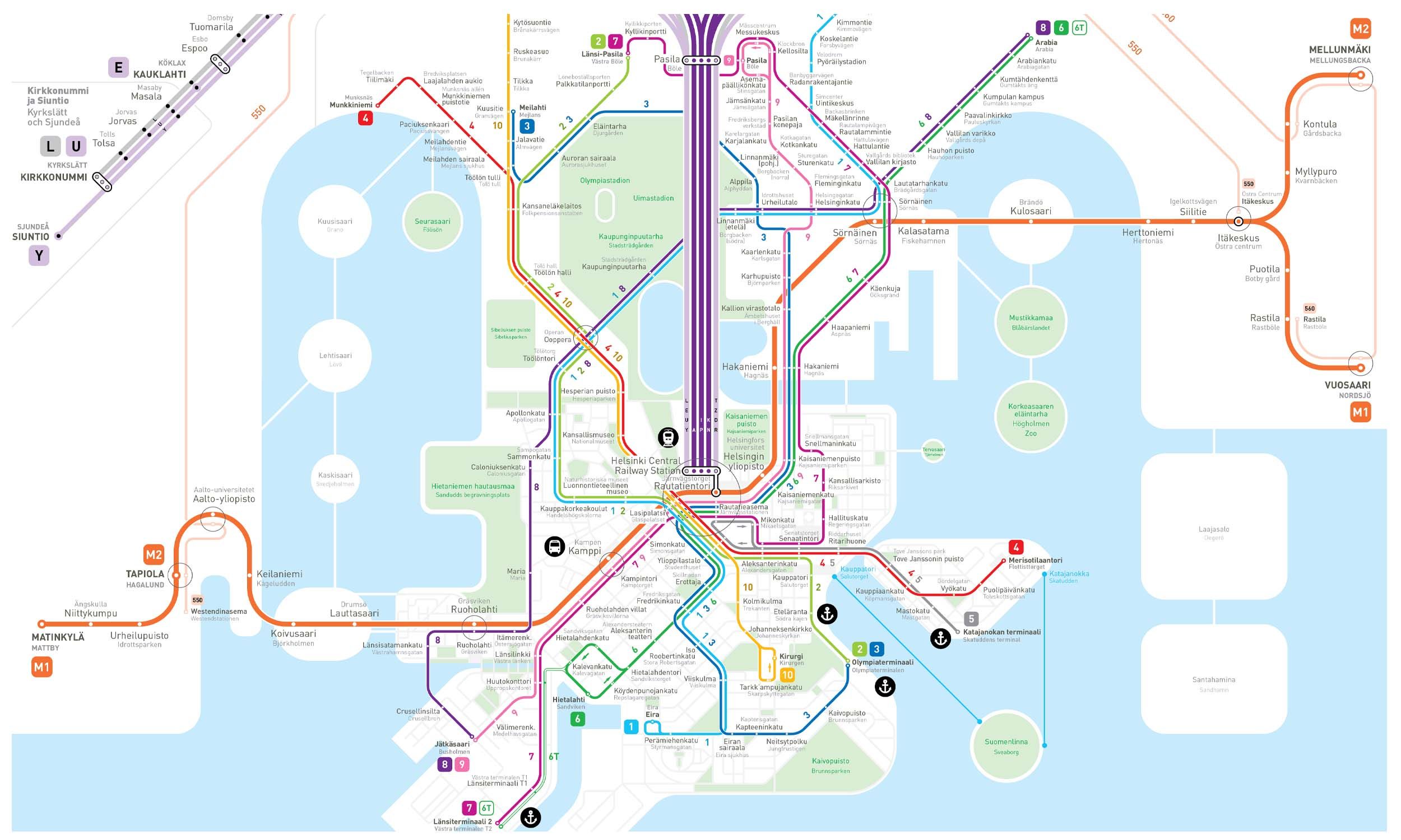
Line M1 runs between Kivenlahti and Vuosaari. The main line opened in 1982, with western extensions completed in 2017 and 2022. The entire route is over 22 km long and has approximately 20-25 stations, depending on shared sections. The line is approximately 35 km long and has 25 stations. Major interchange points include Helsinki Central, Itäkeskus, and Kamppi.
Helsinki Metro Map 2026
Click to expand
Other Lines in Helsinki Metro
Frequently Asked Questions — M1 Line
M1 Line has 26 stations on the Helsinki Metro network.
M1 Line runs between Kivenlahti and Rastila.
M1 Line is approximately 36.9 km long.
M1 Line opened in 1982.
M1 Line is a Metro line operated under Helsinki Metro.
M1 Line is part of the Helsinki Metro transit network.