
Line 1 Info
- Network Lille Metro
- Operation Started 1983
- Total Length 13.5 km
- Total Stations 18
Terminals
From
C.H.R. B-Calmette
To
Cantons
Line 1 Overview
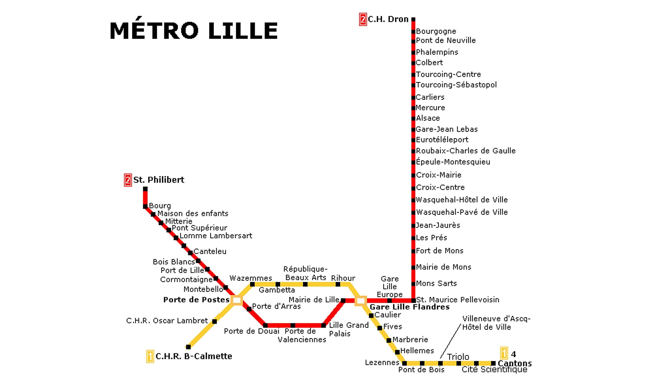
Line 1 opened on April 25, 1983, with 15 stations, was extended to Pont de Bois on May 18, 1984, and reached its current eastern terminus on February 3, 1989. It runs between CHU–Eurasanté and Quatre Cantons–Stade Pierre-Mauroy, is 12.5 km long, and has 18 stations. It connects the municipalities of Lille, Mons-en-Barœul, and Villeneuve-d'Ascq, and provides connections to Line 2, Ilévia buses, and SNCF rail services.
Lille Metro Map 2026
Click to expand
Other Lines in Lille Metro
Frequently Asked Questions — Line 1
Line 1 has 18 stations on the Lille Metro network.
Line 1 runs between C.H.R. B-Calmette and Cantons.
Line 1 is approximately 13.5 km long.
Line 1 opened in 1983.
Line 1 is a Metro line operated under Lille Metro.
Line 1 is part of the Lille Metro transit network.