
U2 Line Info
- Network Vienna U-Bahn Metro
- Operation Started 1980
- Total Length 16.7 km
- Total Stations 15
Terminals
From
Schottentor
To
Seestadt
U2 Line Overview
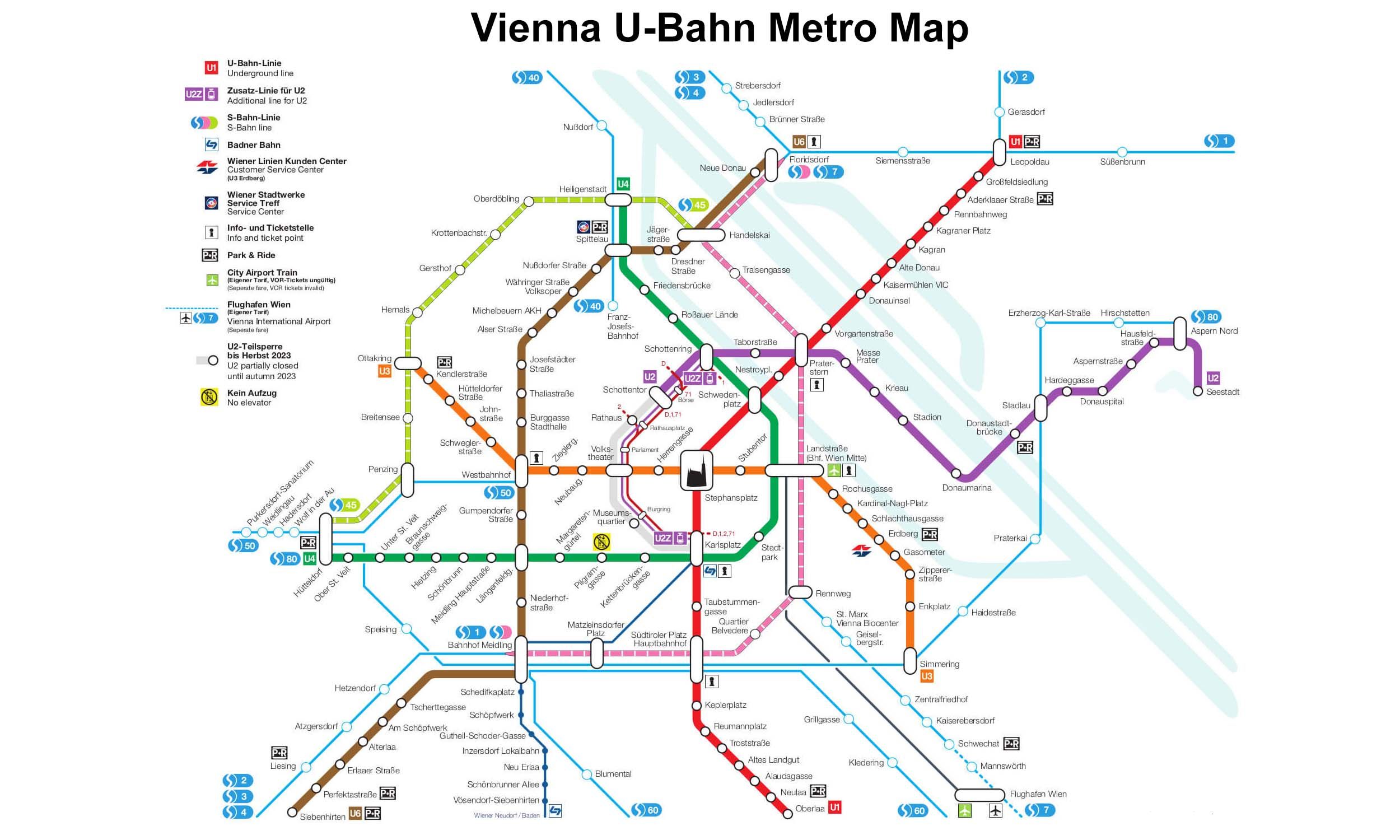
Line U2 is part of the Vienna U-Bahn metro system, currently running between Karlsplatz in the city center and Seestadt in the east. Opened in 1980, the line has been extended in several phases and is 17.2 km long with 21 stations. It connects with the U1, U3, and U4 lines, as well as several tram routes, especially at major interchange stations such as Karlsplatz, Schottentor, and Schottenring. The U2 is also undergoing a major expansion project (2021–2028), which includes a planned southern extension towards Matzleinsdorfer Platz and Wienerberg.
Vienna U-Bahn Metro Map 2026
Click to expand
Other Lines in Vienna U-Bahn Metro
Frequently Asked Questions — U2 Line
U2 Line has 15 stations on the Vienna U-Bahn Metro network.
U2 Line runs between Schottentor and Seestadt.
U2 Line is approximately 16.7 km long.
U2 Line opened in 1980.
U2 Line is a Metro line operated under Vienna U-Bahn Metro.
U2 Line is part of the Vienna U-Bahn Metro transit network.