
M1 Line Info
- Network Warsaw Metro
- Total Length 22.7 km
- Total Stations 21
Terminals
From
Kabaty
To
Młociny
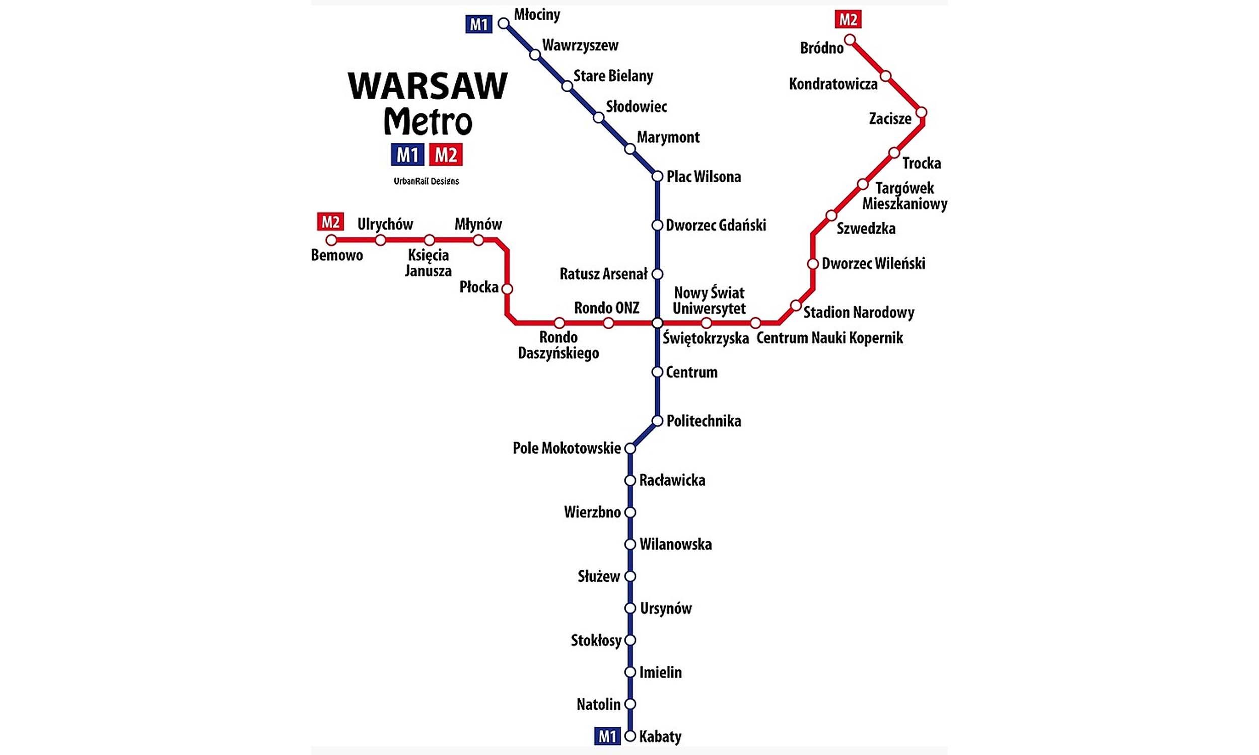
M1 Line Overview
M1 line runs from Kabaty Station to Młociny Station. The line was inaugurated on April 7, 1995, and after several phases of expansion, it was completed in October 2008. It is 23.1 kilometres long and has 21 stations. The line connects major interchange stations such as Świętokrzyska, Centrum, and Dworzec Gdański, where passengers can transfer between metro, rail, tram, and bus services.
Warsaw Metro Map 2026
Click to expand
Other Lines in Warsaw Metro
Frequently Asked Questions — M1 Line
M1 Line has 21 stations on the Warsaw Metro network.
M1 Line runs between Kabaty and Młociny.
M1 Line is approximately 22.7 km long.
M1 Line is a Metro line operated under Warsaw Metro.
M1 Line is part of the Warsaw Metro transit network.