Changi Airport MRT StationSingapore
CG2
Served by
Changi Airport MRT Station Location on Map
Open in OSM


Changi Airport MRT Station Overview
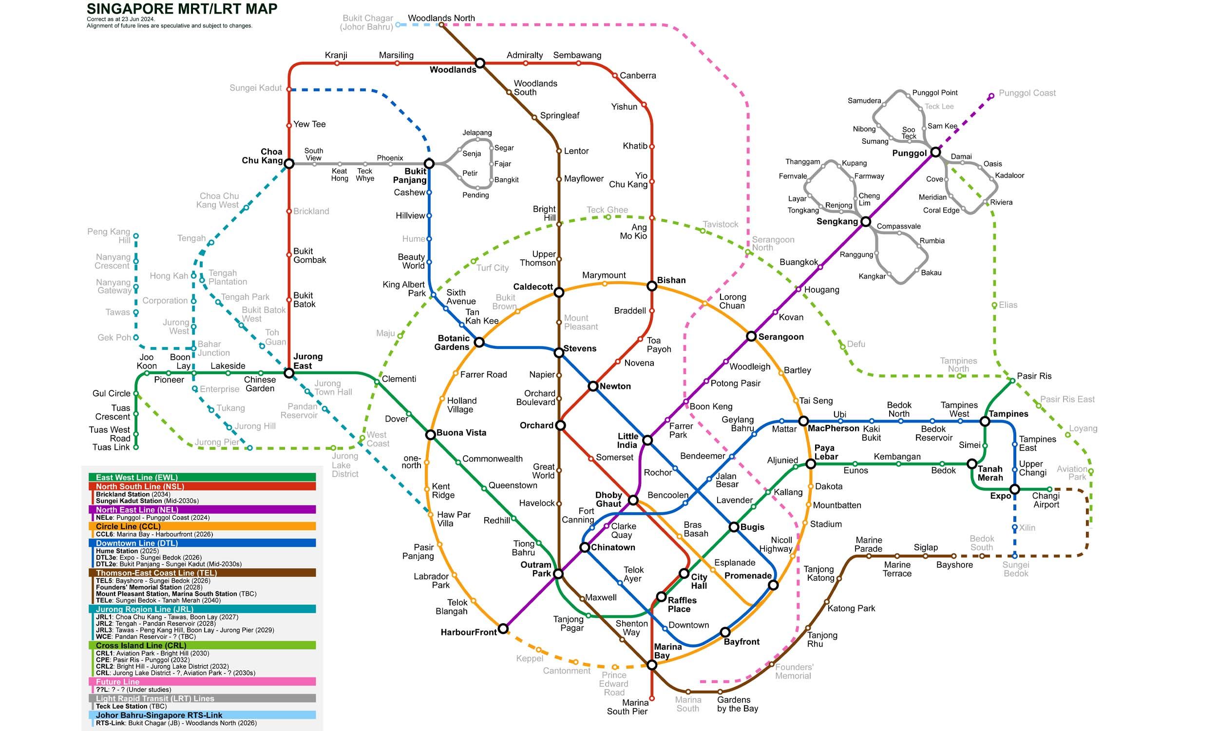
Changi is an underground station on the Thomson-East Coast Line (TEL) of Singapore's MRT network, operated by SMRT Trains and opened on 8 February 2002. It is located beneath Airport Boulevard between Changi Airport Terminal 2 and Terminal 3 and serves Changi Airport Terminals 1, 2 and 3 via internal airport connections. The station is the terminus of the Changi Airport branch of the East-West Line and is connected to Expo station and Tanah Merah station.
Lines at Changi Airport MRT Station
Changi Airport MRT Station Info
- Opened 2002
- Coordinates 1.35957, 103.9864
-
Lines
1
Singapore MRT Map 2026
Click to expand
Other Stations in Singapore MRT
87Frequently Asked Questions — Changi Airport Station
Changi Airport station is served by 1 line: East–West Line.
Changi Airport station is part of the Singapore MRT MRT network in Singapore.
Changi Airport station opened in 2002.
Changi Airport station is located at coordinates 1.35957, 103.9864 in Singapore.
You can reach Changi Airport station via the Singapore MRT MRT. Use the route finder on this page to plan your journey from any station.