
Nicoll Highway MRT StationSingapore
CC5
Interchange
Served by
Nicoll Highway MRT Station Location on Map
Open in OSM


Nicoll Highway MRT Station Overview
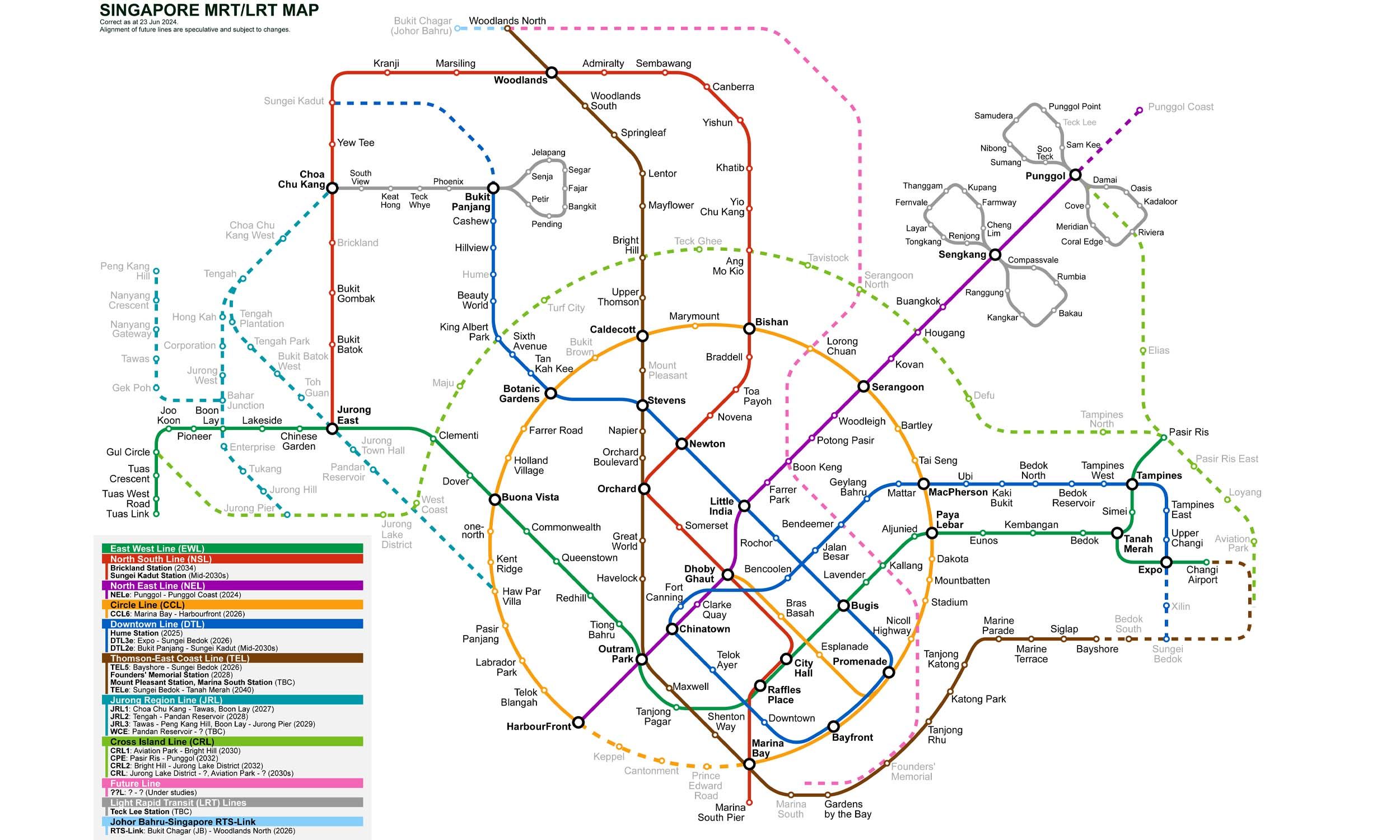
Nicol Highway is an underground station on the Circle Line (CCL) of Singapore's MRT network. Opened on 17 April 2010, the station serves the Beach Road area, the Golden Mile Complex, and Kambong Glam. The station is the 5th station on the Circle Line from Dhoby Ghaut and the 25th from HarbourFront.
Lines at Nicoll Highway MRT Station
Circle Line
Singapore MRT
Platform Island
Underground
Nicoll Highway MRT Station Info
- Opened 2010
- Coordinates 1.30019, 103.8632
-
Lines
Interchange 2
Singapore MRT Map 2026
Click to expand
Other Stations in Singapore MRT
86Frequently Asked Questions — Nicoll Highway Station
Nicoll Highway station is served by 2 lines: Circle Line, Circle Line.
Yes, Nicoll Highway is an interchange station where passengers can transfer between 2 lines.
Nicoll Highway station is part of the Singapore MRT MRT network in Singapore.
Nicoll Highway station opened in 2010.
Nicoll Highway station is located at coordinates 1.30019, 103.8632 in Singapore.
You can reach Nicoll Highway station via the Singapore MRT MRT. Use the route finder on this page to plan your journey from any station.