
M3 Line Info
- Network Budapest Metro
- Operation Started 1976
- Total Length 17.3 km
- Total Stations 20
Terminals
From
Kőbánya-Kispest
To
Újpest-Központ
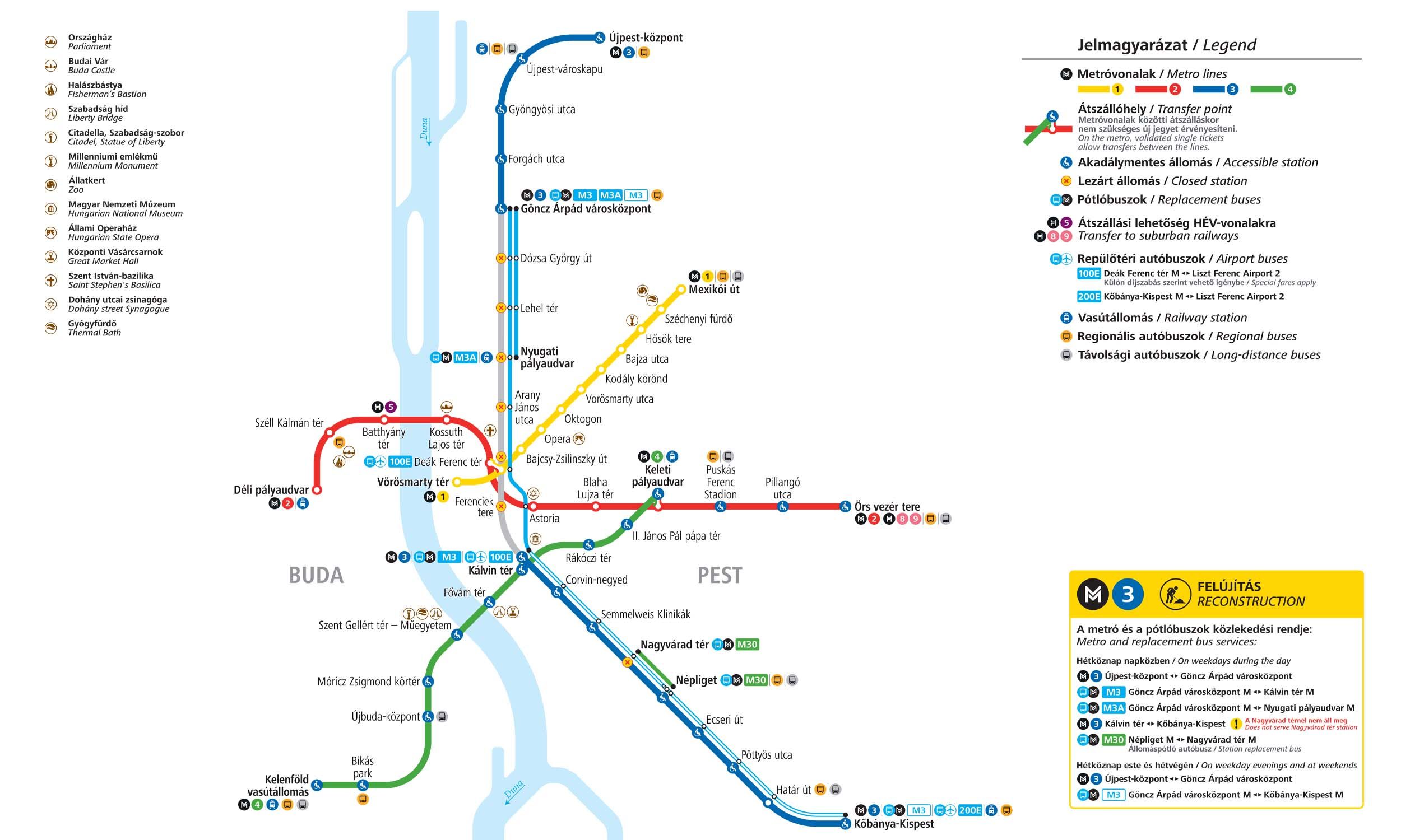
M3 Line Overview
Line M3 is the longest line of the Budapest Metro. It runs north-south in the Pest region of the city from Újpest-Központ to Kőbánya-Kispest, covering a distance of 16.5 km and serving 20 stations. Its first phase was opened on December 31, 1976, between Deák Ferenc Tér and Nagyvárad Tér. The line was expanded in stages, reaching its full length in 1990. It connects with the M1 and M2 at Deák Ferenc Tér and the M4 at Kelvin Terper.
Budapest Metro Map 2026
Click to expand
Other Lines in Budapest Metro
Frequently Asked Questions — M3 Line
M3 Line has 20 stations on the Budapest Metro network.
M3 Line runs between Kőbánya-Kispest and Újpest-Központ.
M3 Line is approximately 17.3 km long.
M3 Line opened in 1976.
M3 Line is a Metro line operated under Budapest Metro.
M3 Line is part of the Budapest Metro transit network.