
M2 Line Info
- Network Copenhagen Metro
- Operation Started 2002
- Total Length 14.2 km
- Total Stations 7
Terminals
From
Amagerbro
To
Lufthavnen
M2 Line Overview
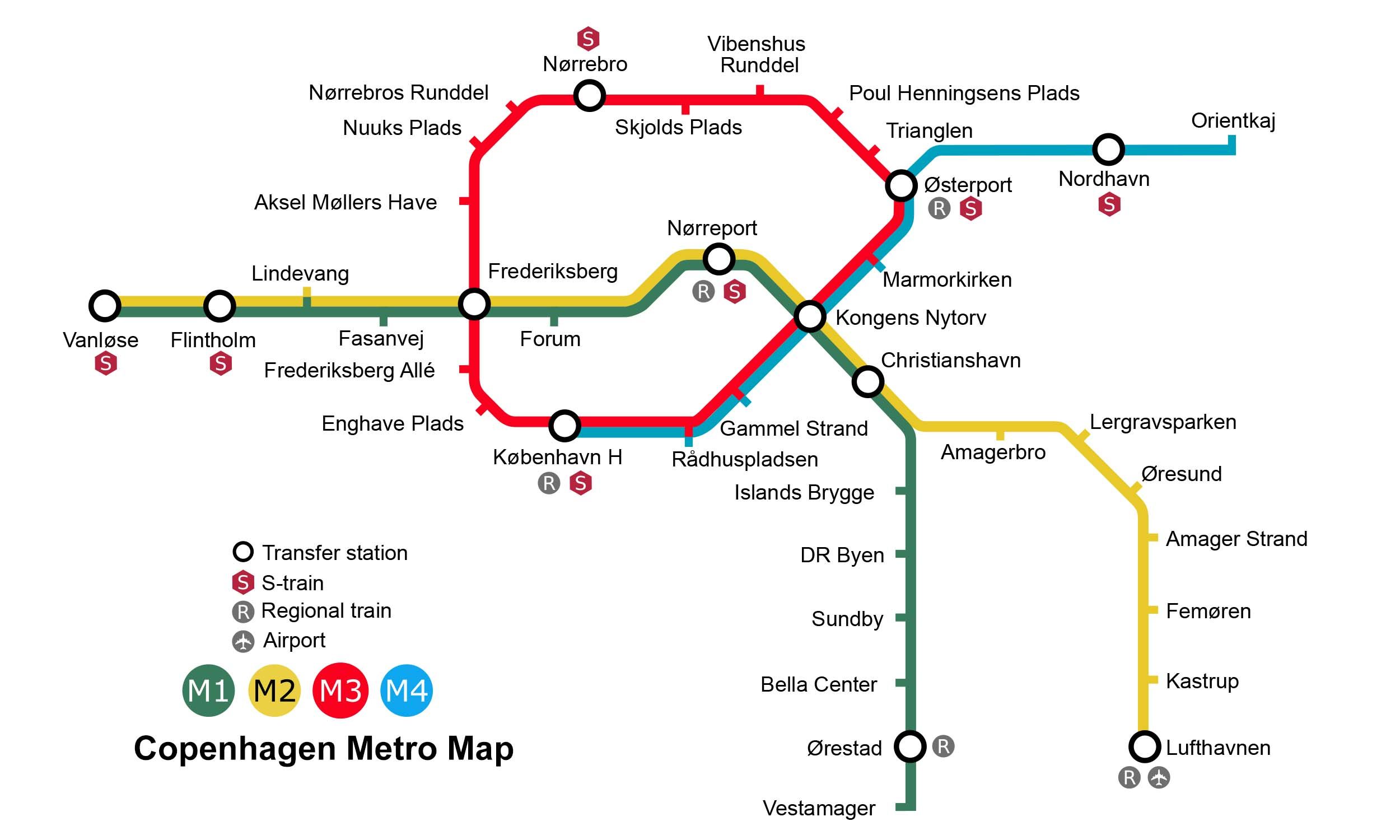
Line M2 runs through the middle of Copenhagen from Vanløse to Lufthavn and shares tracks with the M1 line that runs from Vanløse to Christianshavn. The line was constructed alongside the M1 as part of the redevelopment of Ørestad. The principle for this line was passed in 1992 and construction began in 1998. The line was opened in several phases between 2002 and 2007. The line is 14.2 kilometers long and has 16 stations. The M2 is one of Copenhagen's most important transportation routes, providing direct metro service from the city center to Copenhagen Airport via Nørreport in approximately 15 minutes. Major interchange stations on the line are Frederiksberg, Nørreport, Kongens Nytorv, and Christianshavn.
Copenhagen Metro Map 2026
Click to expand
Other Lines in Copenhagen Metro
Frequently Asked Questions — M2 Line
M2 Line has 7 stations on the Copenhagen Metro network.
M2 Line runs between Amagerbro and Lufthavnen.
M2 Line is approximately 14.2 km long.
M2 Line opened in 2002.
M2 Line is a Metro line operated under Copenhagen Metro.
M2 Line is part of the Copenhagen Metro transit network.