
M1 Line Info
- Network Istanbul Metro
- Operation Started 1989
- Total Length 26.8 km
- Total Stations 18
Terminals
From
Yenikapı
To
Atatürk Havalimanı Airport
M1 Line Overview
The M1A is one of two branches of the Istanbul Metro Line M1 and is part of the rapid transit corridor. This line opened on September 3, 1989, runs from Yenikapı to Atatürk Havalimani Airport and is part of the 26.8-kilometer-long M1 system. It also provides interchange with Marmaray, Metrobus, tram, and several metro lines throughout the city.
Istanbul Metro Map 2026
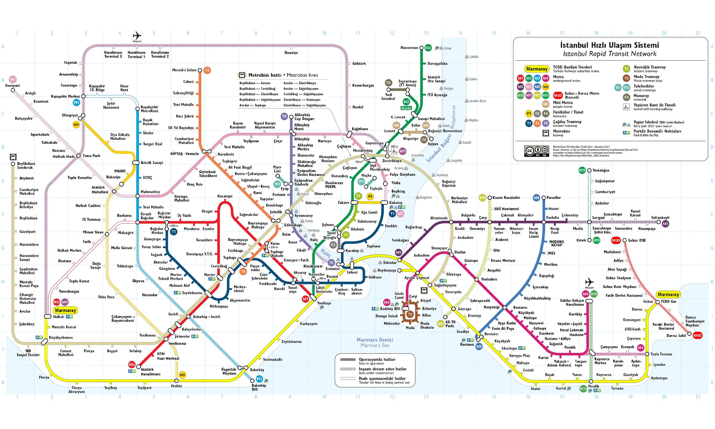
Click to expand
Other Lines in Istanbul Metro
M1 Line
Yenikapı ↔ Kirazlı
M11 Line
M2 Line
Yenikapı ↔ Hacıosman
M2 Line
Sanayi Mahallesi ↔ Seyrantepe
M3 Line
Bakırköy Sahil ↔ Kayaşehir Merkez
M4 Line
Kadıköy ↔ Sabiha Gökçen Airport
M5 Line
Üsküdar ↔ Samandıra Merkez
M6 Line
Levent ↔ Boğaziçi Üniversitesi Hisarüstü
M7 Line
Kabataş ↔ Fulya
M8 Line
M9 Line
Frequently Asked Questions — M1 Line
M1 Line has 18 stations on the Istanbul Metro network.
M1 Line runs between Yenikapı and Atatürk Havalimanı Airport.
M1 Line is approximately 26.8 km long.
M1 Line opened in 1989.
M1 Line is a Metro line operated under Istanbul Metro.
M1 Line is part of the Istanbul Metro transit network.