M2 Line Info
- Network Kyiv Metro
- Operation Started 1976
- Total Length 21.0 km
- Total Stations 18
Terminals
From
Heroiv Dnipra
To
Teremky
M2 Line Overview
The M2 line is called the Obolonsko-Teremkyska line. Its first phase opened on December 17, 1976, and was later extended to northern and southern Kyiv in several stages. The line runs from Heroiv Dnipra to Teremky, is 20.9 kilometers long and has 18 stations. It provides interchange with the M1 and M3.
Kyiv Metro Map 2026
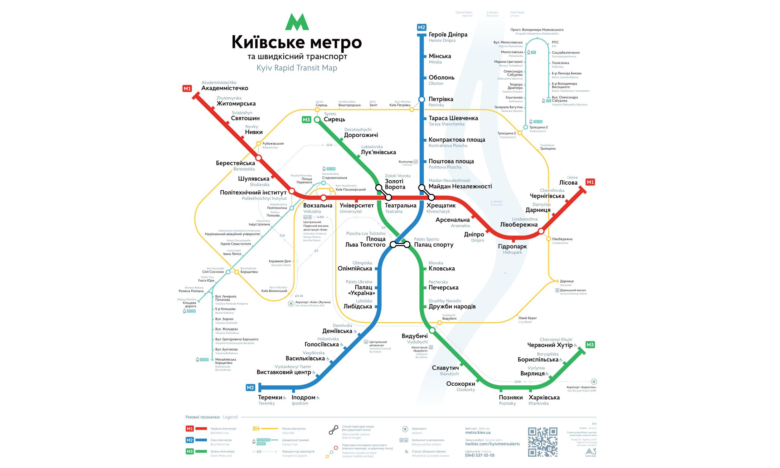
Click to expand
Other Lines in Kyiv Metro
Frequently Asked Questions — M2 Line
M2 Line has 18 stations on the Kyiv Metro network.
M2 Line runs between Heroiv Dnipra and Teremky.
M2 Line is approximately 21.0 km long.
M2 Line opened in 1976.
M2 Line is a Metro line operated under Kyiv Metro.
M2 Line is part of the Kyiv Metro transit network.