
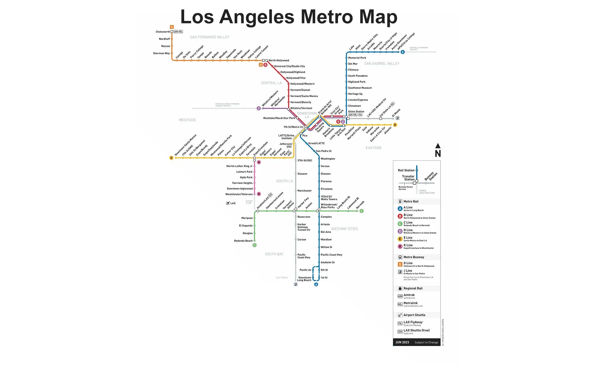
Line A Info
- Network Los Angeles Metro
- Operation Started 1990
- Total Length 78.1 km
- Total Stations 44
Terminals
From
APU/Citrus College
To
Pacific Avenue
Line A Overview
A Line runs from Pomona to Long Beach, covering a length of 92.7 kilometers and serving 48 stations. The line first opened on July 14, 1990, as the Blue Line between Downtown Los Angeles and Long Beach. Following the Foothill Extension project, it was extended northward to Pasadena in 2003, Azusa in 2016, and Pomona in 2025. The Regional Connector project, scheduled to begin in 2023, will connect the former Blue and Gold/L Lines into a continuous route through Downtown Los Angeles. The line interchanges with Metrolink and Amtrak services at Union Station, as well as the B, C, D, E, and K Lines.
Los Angeles Metro Map 2026
Click to expand
Other Lines in Los Angeles Metro
Frequently Asked Questions — Line A
Line A has 44 stations on the Los Angeles Metro network.
Line A runs between APU/Citrus College and Pacific Avenue.
Line A is approximately 78.1 km long.
Line A opened in 1990.
Line A is a Light-rail line operated under Los Angeles Metro.
Line A is part of the Los Angeles Metro transit network.