
Line 2 Info
- Network Montreal Metro
- Operation Started 1966
- Total Length 30.0 km
- Total Stations 31
Terminals
From
Côte-Vertu
To
Montmorency
Line 2 Overview
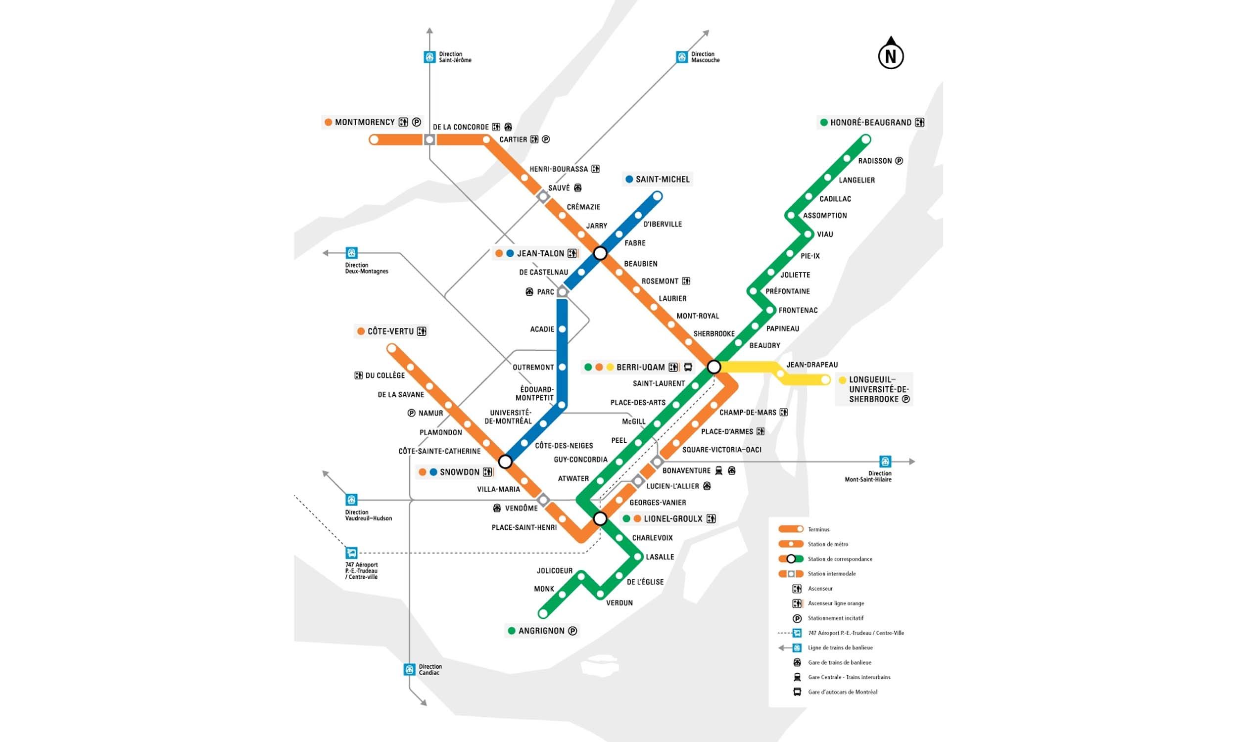
The first phase of Montreal Metro Line 2, Henri-Bourassa–Place-d'Armes, opened to public service on October 14, 1966. The line was extended westward to Côte-Vertu and eastward through downtown to Montmorency in several stages, with the last extension completed in 2007. It is approximately 30 km long, with 31 stations and includes major interchange stations such as Berri-UQAM, Jean-Talon, and Lionel-Groulx, forming a U-shaped route across the city.
Montreal Metro Map 2026
Click to expand
Other Lines in Montreal Metro
Frequently Asked Questions — Line 2
Line 2 has 31 stations on the Montreal Metro network.
Line 2 runs between Côte-Vertu and Montmorency.
Line 2 is approximately 30.0 km long.
Line 2 opened in 1966.
Line 2 is a Metro line operated under Montreal Metro.
Line 2 is part of the Montreal Metro transit network.