
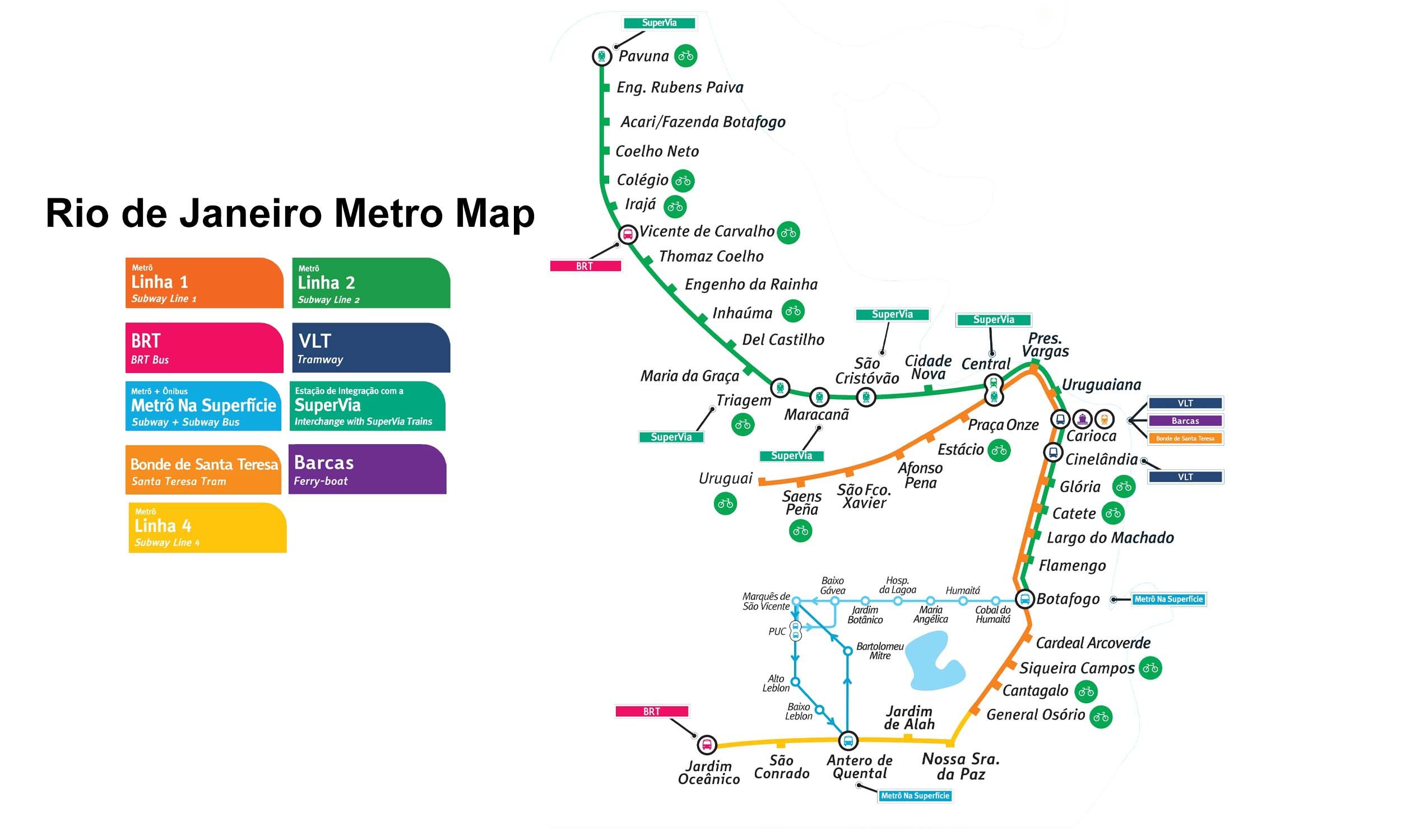
Line 2 Info
- Network Rio de Janeiro Metro
- Operation Started 1981
- Total Length 30.0 km
- Total Stations 26
Terminals
From
Botafogo
To
Pavuna
Line 2 Overview
Line 2 runs from Pavuna to Botafogo and was opened in 1981. It is approximately 30 km long, has approximately 26 stations, and is mostly elevated or at ground level. It shares tracks with Line 1 between Central and Botafogo, providing direct access to the central and southern areas and serving as key interchange points throughout the network.
Rio de Janeiro Metro Map 2026
Click to expand
Other Lines in Rio de Janeiro Metro
Frequently Asked Questions — Line 2
Line 2 has 26 stations on the Rio de Janeiro Metro network.
Line 2 runs between Botafogo and Pavuna.
Line 2 is approximately 30.0 km long.
Line 2 opened in 1981.
Line 2 is a Metro line operated under Rio de Janeiro Metro.
Line 2 is part of the Rio de Janeiro Metro transit network.