
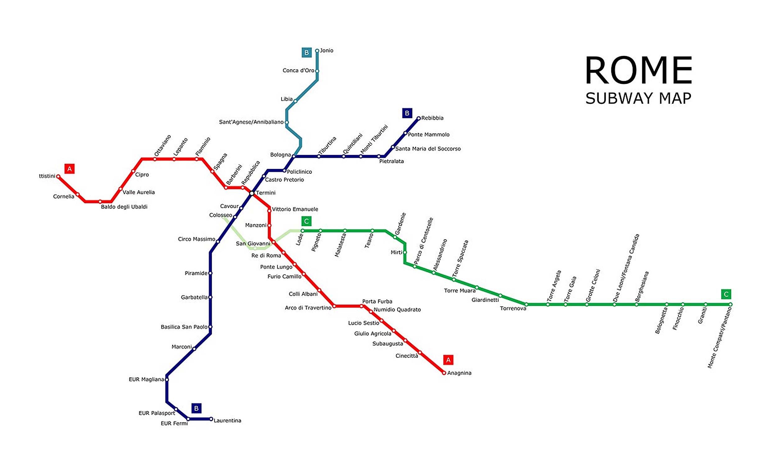
Line A Info
- Network Rome Metro
- Operation Started 1980
- Total Length 18.4 km
- Total Stations 27
Terminals
From
Battistini
To
Anagnina
Line A Overview
Line A runs 18 km from Battistini in the northwest to Anagnina in the southeast and has 27 stations. It was inaugurated on February 16, 1980. The line interchanges with Line B at Termini Station and San Giovanni Station. It passes through major tourist areas such as the Spanish Steps and near Vatican City.
Rome Metro Map 2026
Click to expand
Other Lines in Rome Metro
Frequently Asked Questions — Line A
Line A has 27 stations on the Rome Metro network.
Line A runs between Battistini and Anagnina.
Line A is approximately 18.4 km long.
Line A opened in 1980.
Line A is a Metro line operated under Rome Metro.
Line A is part of the Rome Metro transit network.