Line A Info
- Network Rotterdam Metro
- Operation Started 2019
- Total Length 17.2 km
- Total Stations 24
Terminals
From
Vlaardingen West
To
Binnenhof
Line A Overview
Line A runs from Binnenhof station to Schiedam Centrum station. The line first opened on May 6, 1982, between Capelsbrug and Koolhaven, and was later extended to Binnenhof in 1983. The route has 24 stations and serves Rotterdam, Schiedam, and Vlaardingen. Some outer sections of Line A operate as light rail. It primarily serves as a busy commuter link, sharing tracks with Line B (towards Nesselunde) for most of its route. Important interchange stations include Buurs, Blaak, Capelsbrug, Kralingse Zoom, and Schiedam Centrum, where you can transfer to other metro and railway services.
Rotterdam Metro Map 2026
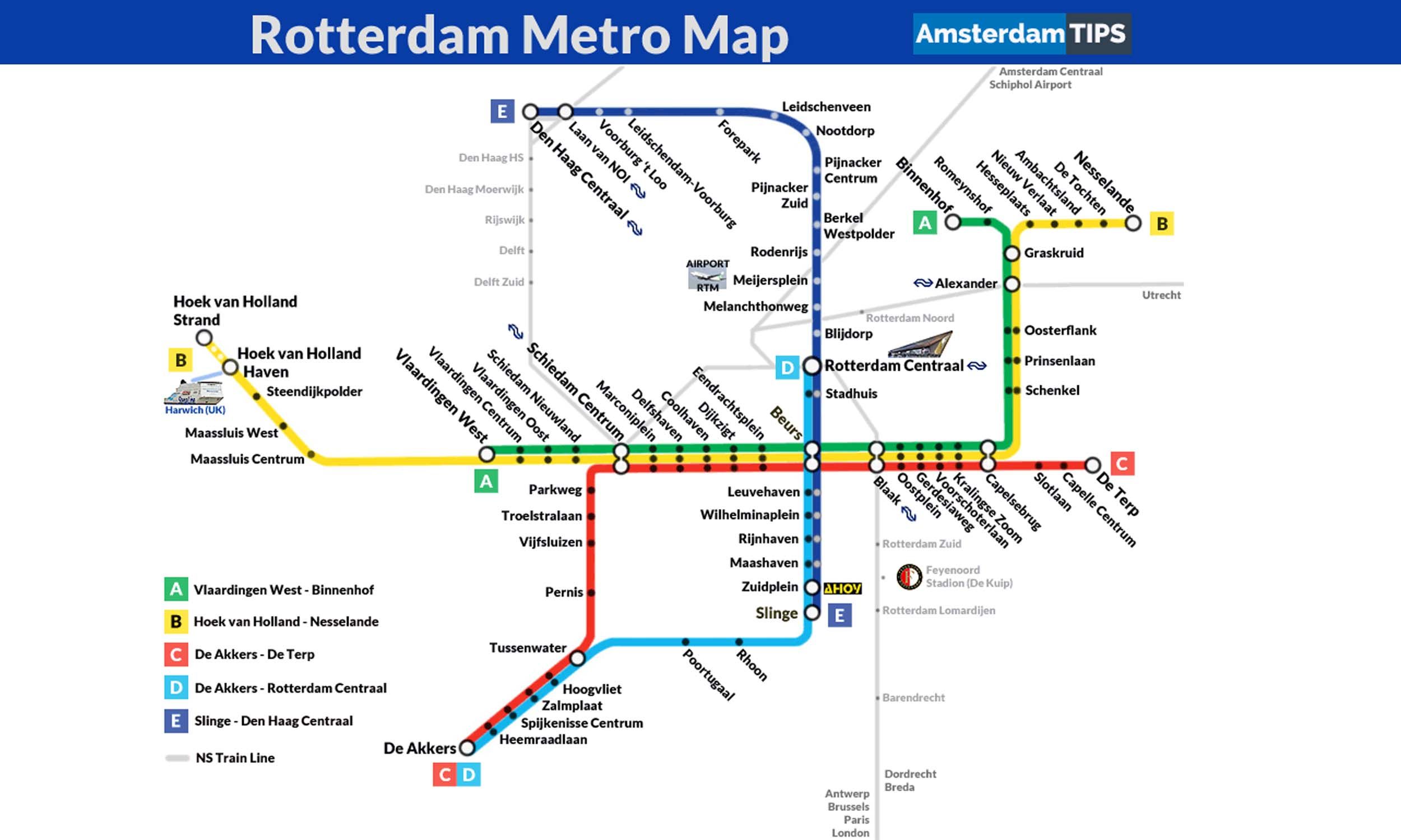
Click to expand
Other Lines in Rotterdam Metro
Frequently Asked Questions — Line A
Line A has 24 stations on the Rotterdam Metro network.
Line A runs between Vlaardingen West and Binnenhof.
Line A is approximately 17.2 km long.
Line A opened in 2019.
Line A is a Light-rail line operated under Rotterdam Metro.
Line A is part of the Rotterdam Metro transit network.