Red Line Info
- Network RTA Rapid Transit
- Operation Started 1859
- Total Length 31.0 km
- Total Stations 18
Terminals
From
Airport
To
Windermere
Red Line Overview
Red Line opened on March 15, 1955, and is the only heavy rail line in Cleveland's rapid transit system. The line was constructed in several phases, extending to Cleveland Hopkins International Airport in 1968. It provides interchange with the Blue, Green, and Waterfront lines at Tower City-Public Square and shared stations at East 55th and Tri-C-Campus District.
RTA Rapid Transit Map 2026
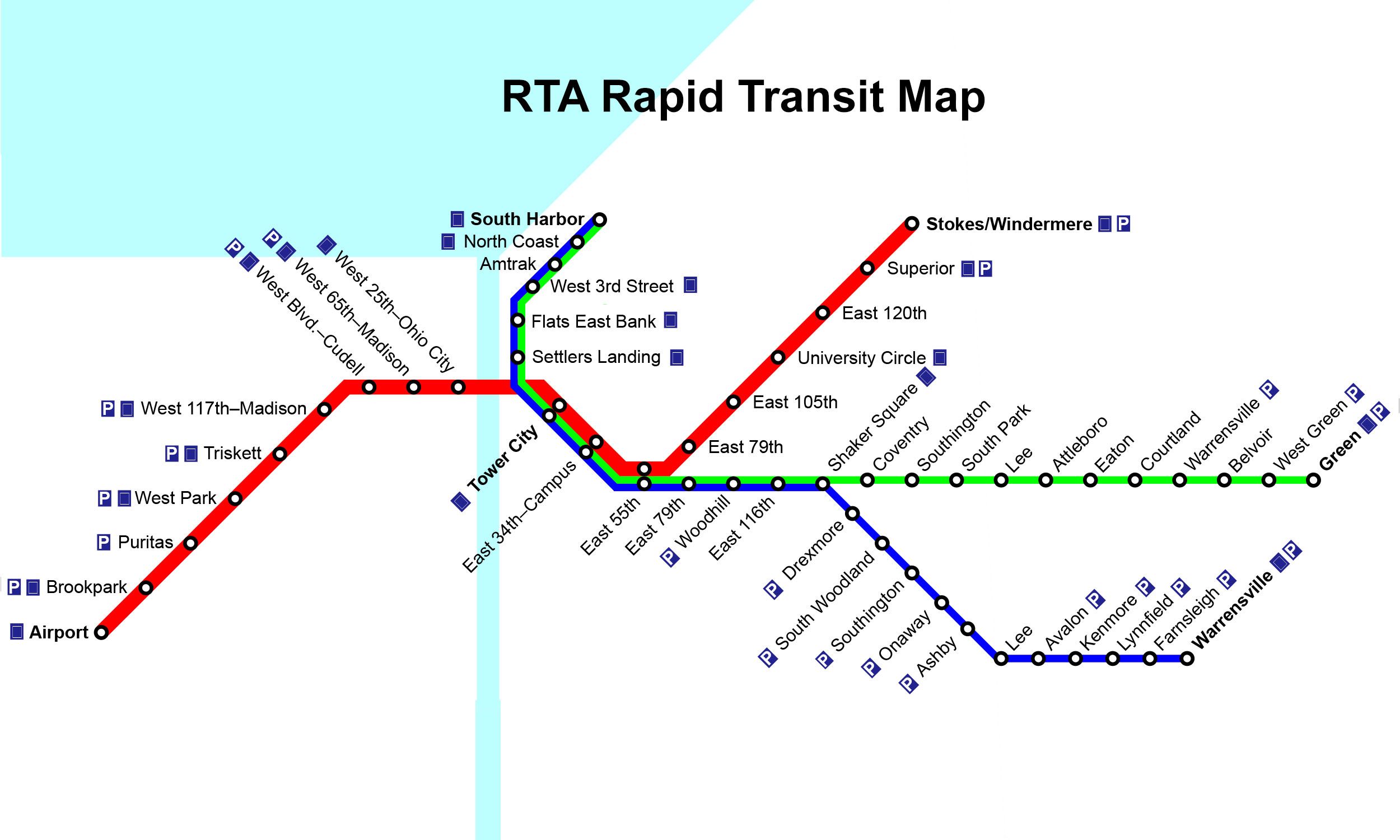
Click to expand
Other Lines in RTA Rapid Transit
Frequently Asked Questions — Red Line
Red Line has 18 stations on the RTA Rapid Transit network.
Red Line runs between Airport and Windermere.
Red Line is approximately 31.0 km long.
Red Line opened in 1859.
Red Line is a Metro line operated under RTA Rapid Transit.
Red Line is part of the RTA Rapid Transit transit network.