
Yellow Line Info
- Network Tyne and Wear Metro
- Total Stations 42
Terminals
From
St James
To
South Shields
Yellow Line Overview
The Yellow Line opened on August 11, 1980, and is the main circular route of the Metro network. The line runs along the North Tyneside Loop between St. James's and South Shields, passing through Newcastle city center twice in a distinctive "pretzel" configuration. The line is 50.5 kilometers long and has 41 stations, making it the longest route in the system. It also shares tracks with the Green Line between Pella and South Gosforth, which connects Newcastle, North Tyneside, Gateshead and South Tyneside.
Tyne and Wear Metro Map 2026
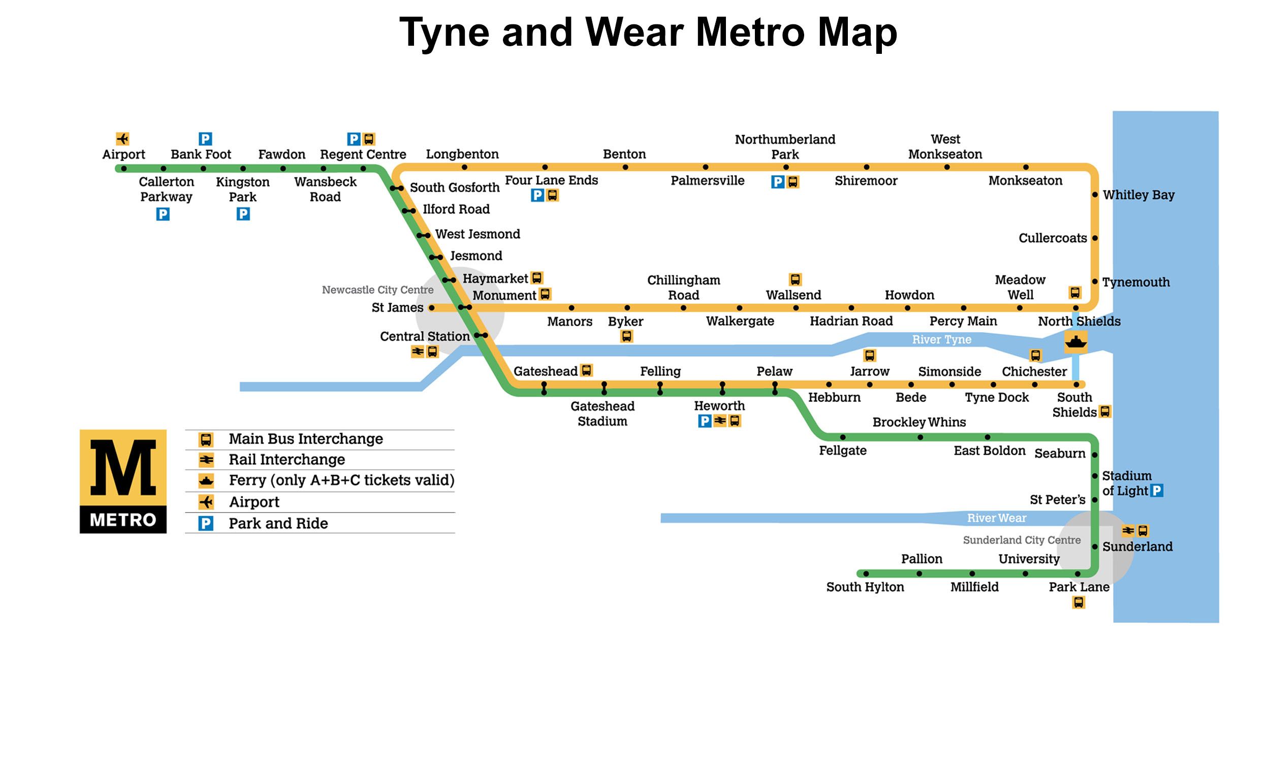
Click to expand
Other Lines in Tyne and Wear Metro
Frequently Asked Questions — Yellow Line
Yellow Line has 42 stations on the Tyne and Wear Metro network.
Yellow Line runs between St James and South Shields.
Yellow Line is a Metro line operated under Tyne and Wear Metro.
Yellow Line is part of the Tyne and Wear Metro transit network.