Pasir Panjang MRT StationSingapore
CC26
Interchange
Served by
Pasir Panjang MRT Station Location on Map
Open in OSM


Pasir Panjang MRT Station Overview
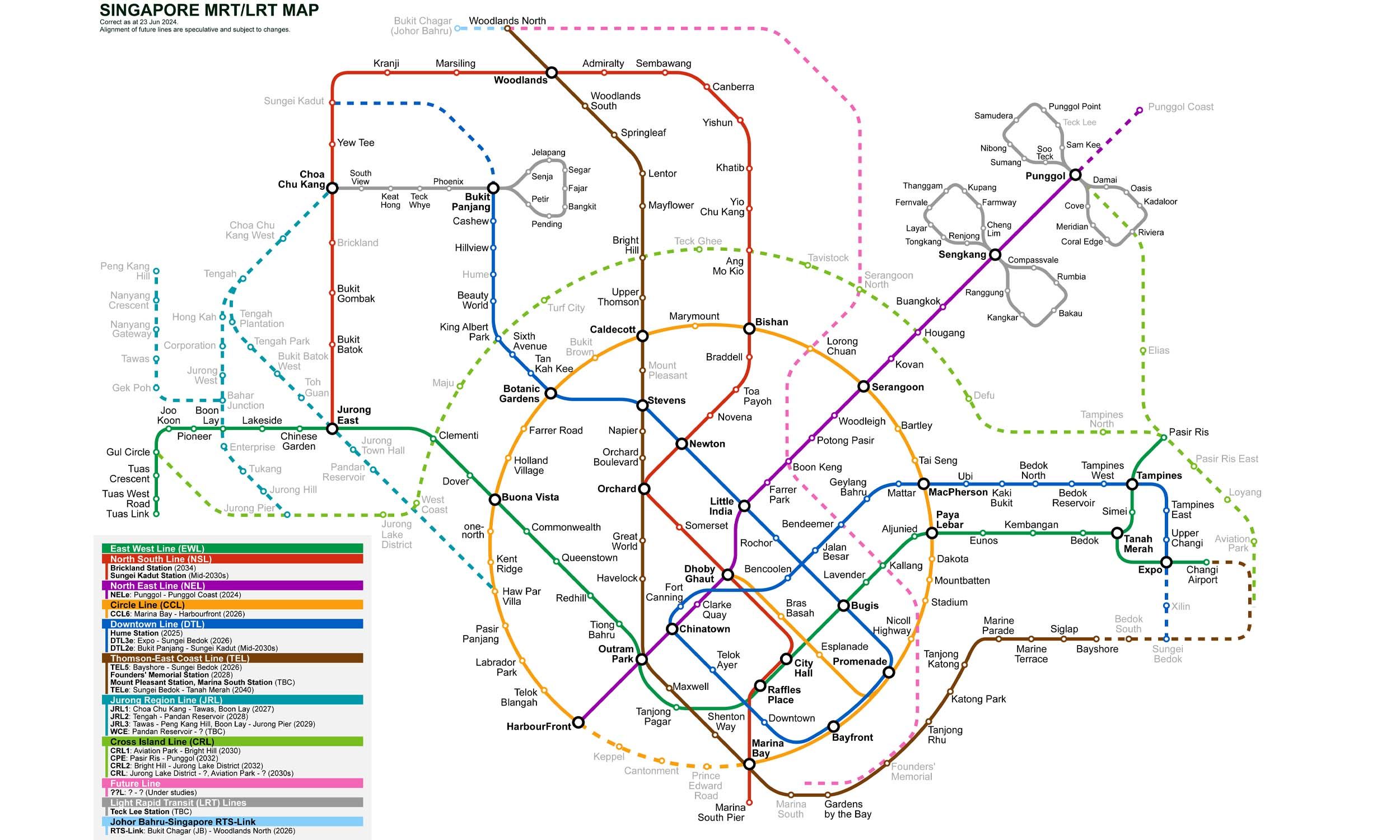
Pasir Panjang is an underground station on the Circle Line of Singapore's MRT network. It is located between Haw Par Villa and Labrador Park stations. It primarily serves the industrial and port-related areas located along Pasir Panjang Road and was opened in 2011. The station is the 26th station on the Circle Line from Dhoby Ghaut and the 4th from HarbourFront.
Lines at Pasir Panjang MRT Station
Circle Line
Singapore MRT
Platform Island
Underground
Circle Line
Singapore MRT
Platform Island
Underground
Pasir Panjang MRT Station Info
- Opened 2011
- Coordinates 1.27605, 103.79132
-
Lines
Interchange 2
Singapore MRT Map 2026
Click to expand
Other Stations in Singapore MRT
86Frequently Asked Questions — Pasir Panjang Station
Pasir Panjang station is served by 2 lines: Circle Line, Circle Line.
Yes, Pasir Panjang is an interchange station where passengers can transfer between 2 lines.
Pasir Panjang station is part of the Singapore MRT MRT network in Singapore.
Pasir Panjang station opened in 2011.
Pasir Panjang station is located at coordinates 1.27605, 103.79132 in Singapore.
You can reach Pasir Panjang station via the Singapore MRT MRT. Use the route finder on this page to plan your journey from any station.