
Line 1 Stations (21)
Line 1 Info
- Network Brussels Metro
- Operation Started 2009
- Total Length 12.5 km
- Total Stations 21
Terminals
From
Weststation
To
Stokkel
Line 1 Overview
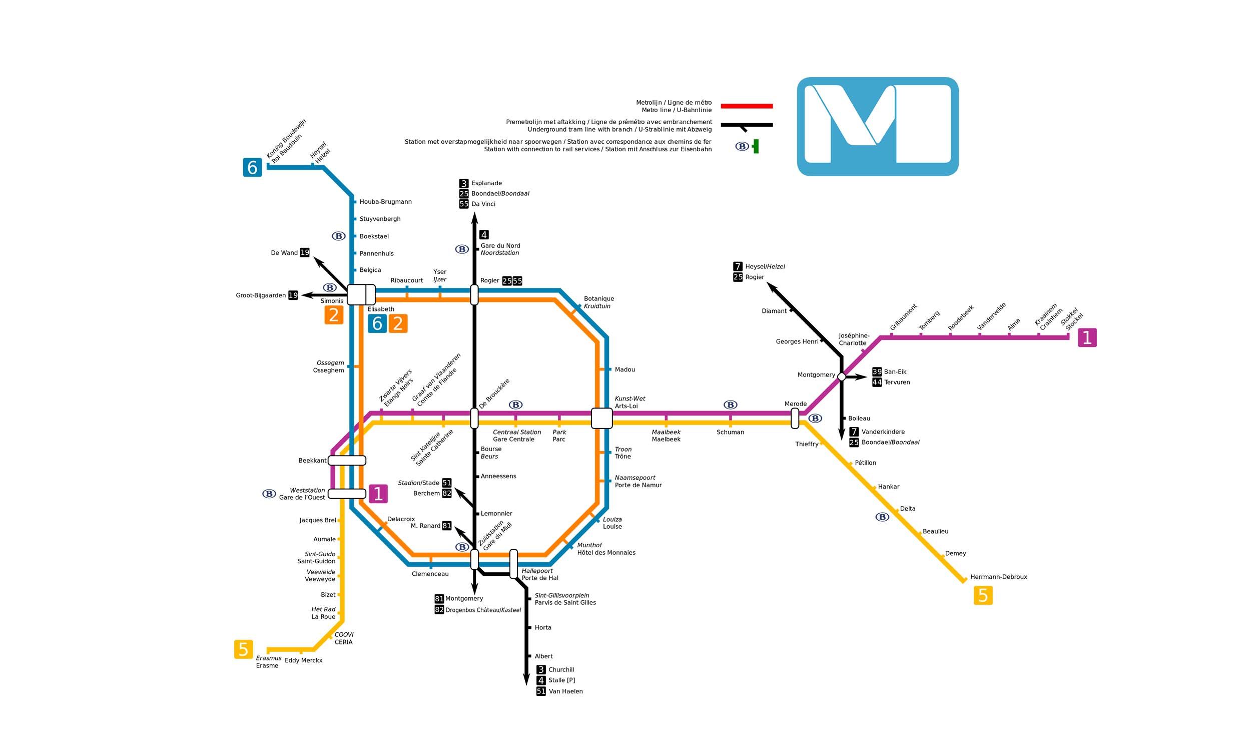
Brussels Metro Line 1, in its current form, has been in operation since 4 April 2009, although parts of the route were initially developed as premetro sections, built before being upgraded to full metro service. The line runs from Gare de l'Ouest (Weststation) to Stokele, covering a distance of approximately 12.5 km with 21 stations. It crosses the city from west to east, passing through central areas such as De Bruyckere, Gare Centrale and Schuman, and sharing tracks with other lines in the interior. Over time, the route has been extended and rebuilt, making it one of the main east-west corridors of the Brussels Metro network.
Brussels Metro Map 2026
Click to expand
Other Lines in Brussels Metro
Frequently Asked Questions — Line 1
Line 1 has 21 stations on the Brussels Metro network.
Line 1 runs between Weststation and Stokkel.
Line 1 is approximately 12.5 km long.
Line 1 opened in 2009.
Line 1 is a Metro line operated under Brussels Metro.
Line 1 is part of the Brussels Metro transit network.