Line 1 Yonge–University Info
- Network Toronto subway
- Operation Started 1954
- Total Length 38.4 km
- Total Stations 38
Terminals
From
Finch
To
Vaughan Metropolitan Centre
Line 1 Yonge–University Overview
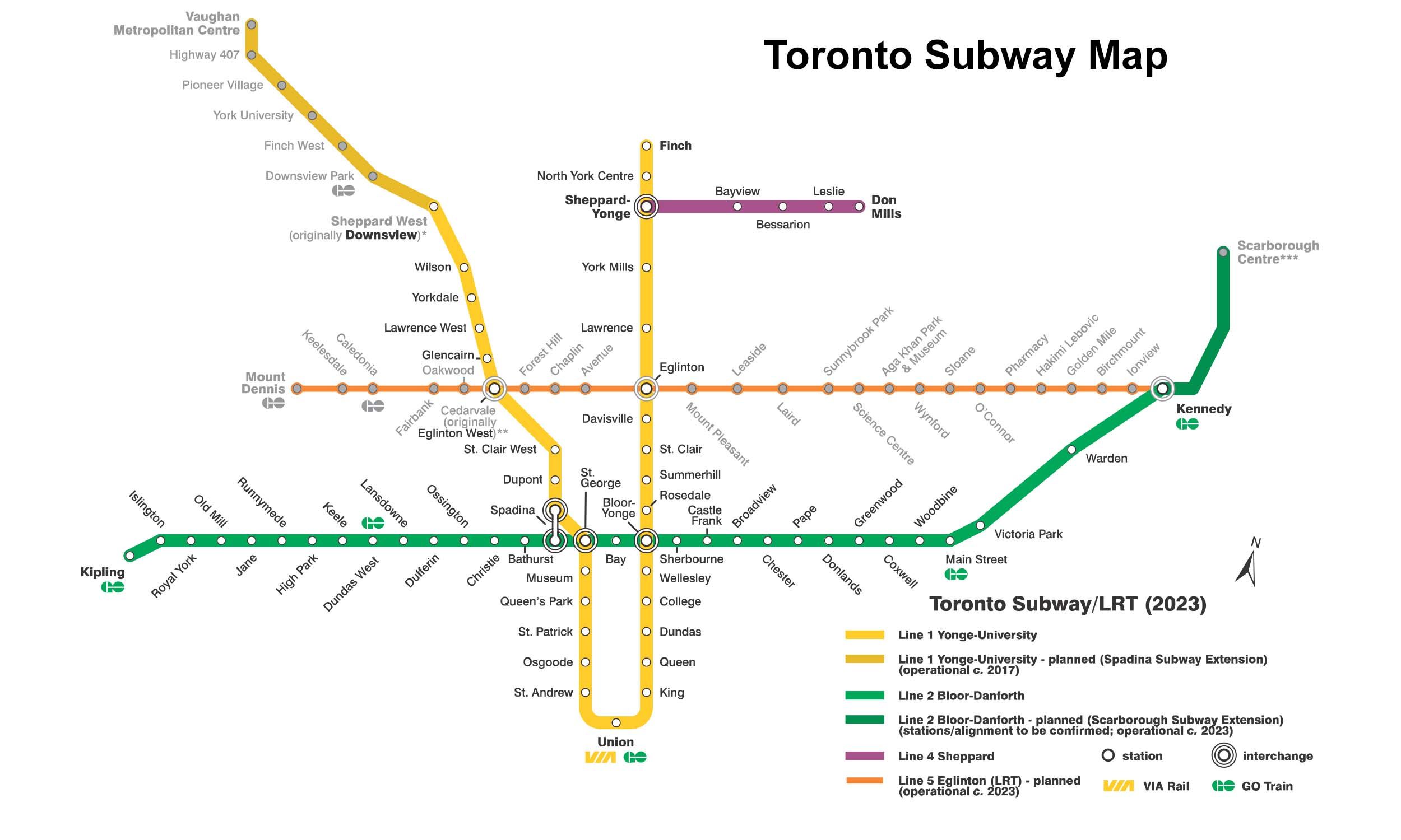
The first phase of Toronto Subway Line 1, the Yonge section from Union to Eglinton, opened to public service on March 30, 1954, as the first subway in Canada. The University section opened in 1963, creating a U-shaped route. The line was extended north in stages to Finch and later to Vaughan Metropolitan Centre in 2017. It now runs between Vaughan Metropolitan Centre and Finch, covering a distance of approximately 38.8 km with 38 stations, and includes major interchange stations such as Bloor–Yonge, St. George and Sheppard–Yonge.
Toronto subway Map 2026
Click to expand
Other Lines in Toronto subway
Frequently Asked Questions — Line 1 Yonge–University
Line 1 Yonge–University has 38 stations on the Toronto subway network.
Line 1 Yonge–University runs between Finch and Vaughan Metropolitan Centre.
Line 1 Yonge–University is approximately 38.4 km long.
Line 1 Yonge–University opened in 1954.
Line 1 Yonge–University is a Metro line operated under Toronto subway.
Line 1 Yonge–University is part of the Toronto subway transit network.