
M1 Line Info
- Network Ankara Metro
- Operation Started 1905
- Total Length 14.7 km
- Total Stations 12
Terminals
From
Kızılay
To
Batıkent
M1 Line Overview
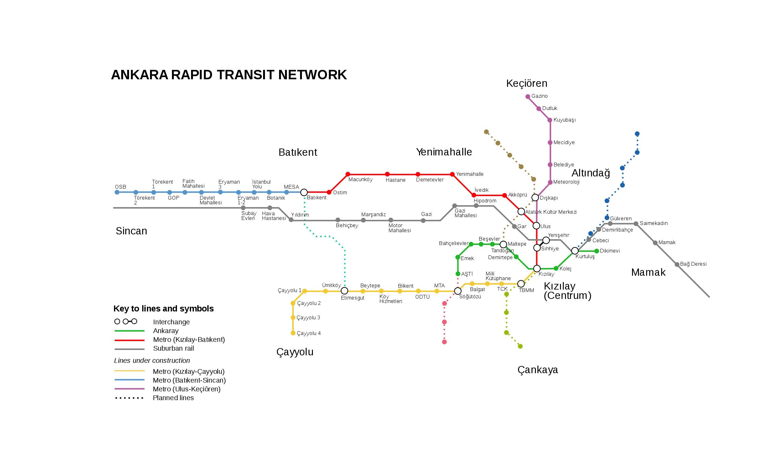
M1 Line opened on December 29, 1997. It runs from Kizilay to Batıkent, is 14.6 kilometers long, with 12 stations. It connects central Ankara with northwestern districts and passes through important areas such as Ulus and Akköprü. Later, the line became part of a continuous metro corridor with the M2 and M3, providing direct metro service to western Ankara.
Ankara Metro Map 2026
Click to expand
Other Lines in Ankara Metro
Frequently Asked Questions — M1 Line
M1 Line has 12 stations on the Ankara Metro network.
M1 Line runs between Kızılay and Batıkent.
M1 Line is approximately 14.7 km long.
M1 Line opened in 1905.
M1 Line is a Metro line operated under Ankara Metro.
M1 Line is part of the Ankara Metro transit network.