
M2 Line Info
- Network Ankara Metro
- Operation Started 1905
- Total Length 16.6 km
- Total Stations 12
Terminals
From
Kızılay
To
Koru
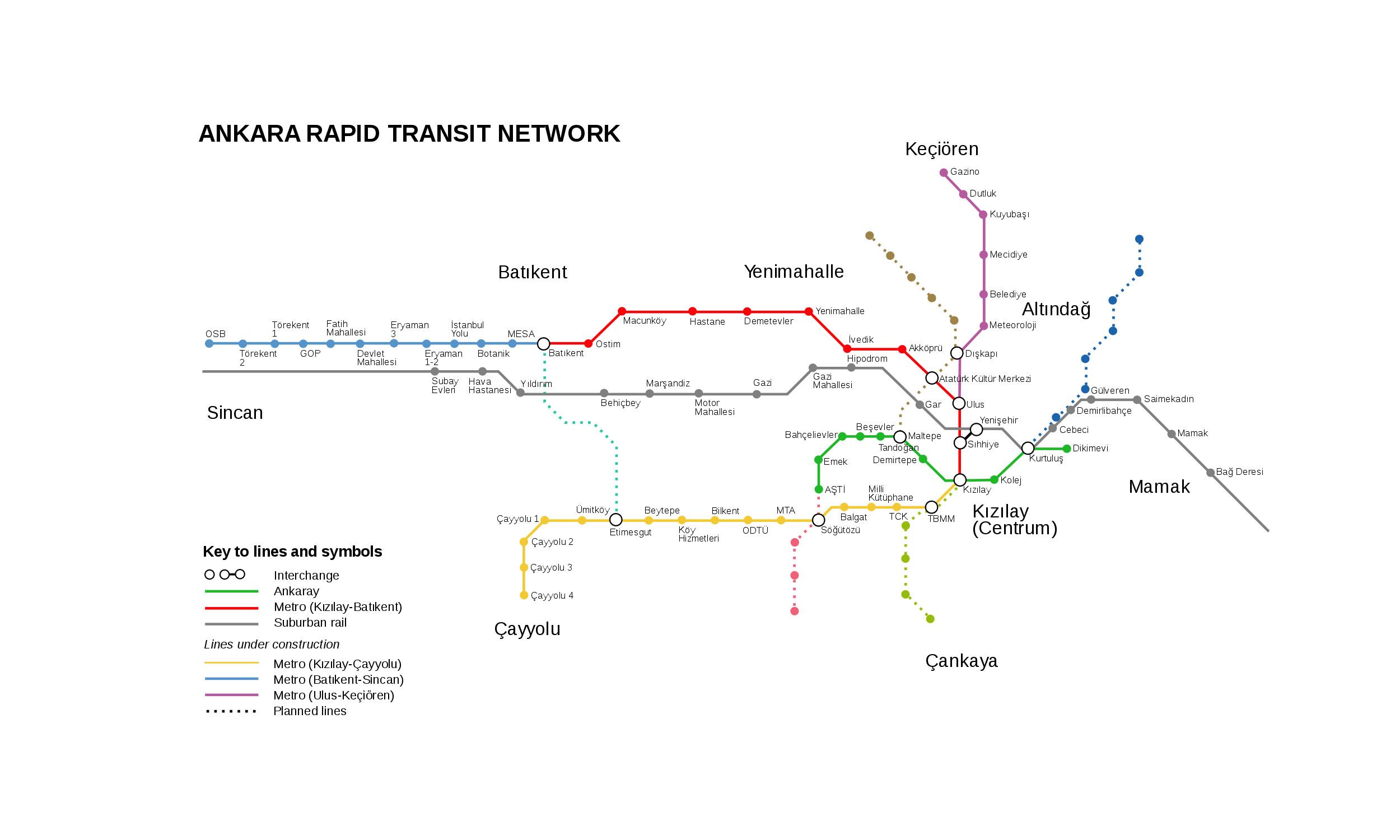
M2 Line Overview
M2 line opened on March 13, 2014. This line runs from Kızılay to Çoru and is 16.5 kilometers long, with 12 stations. It primarily serves southwestern Ankara and connects important areas such as Bilkent, Çayolu, and Çayolu to the city center. The line provides interchange with Ankara and the M1 at Kızılay station.
Ankara Metro Map 2026
Click to expand
Other Lines in Ankara Metro
Frequently Asked Questions — M2 Line
M2 Line has 12 stations on the Ankara Metro network.
M2 Line runs between Kızılay and Koru.
M2 Line is approximately 16.6 km long.
M2 Line opened in 1905.
M2 Line is a Metro line operated under Ankara Metro.
M2 Line is part of the Ankara Metro transit network.