
U2 Line Info
- Network Hamburg U Metro
- Total Length 24.5 km
- Total Stations 25
Terminals
From
Mümmelmannsberg
To
Niendorf Nord
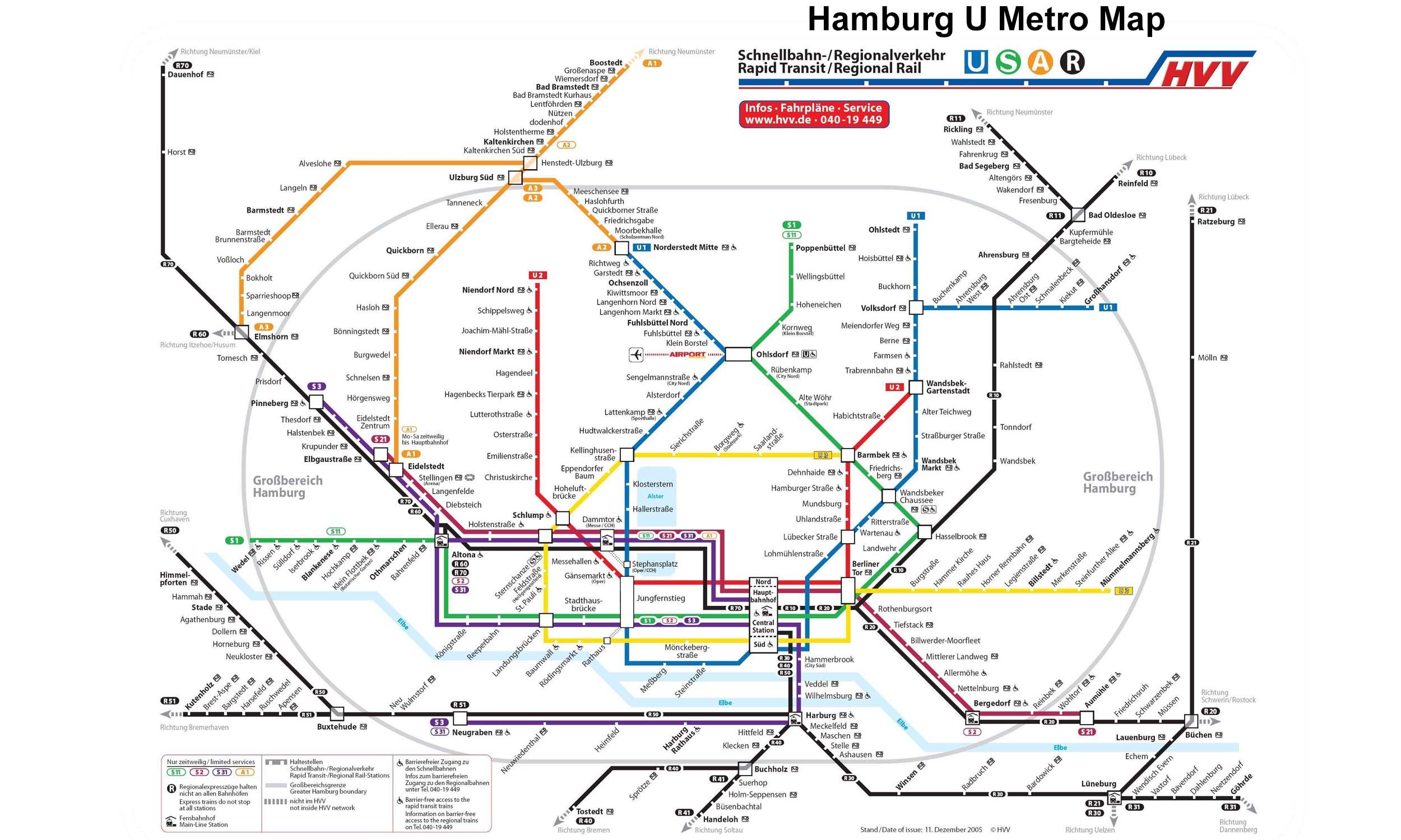
U2 Line Overview
U2 line was opened on 21 October 1913 between Schlump and Emilienstrasse. The line was later extended in several stages towards Niendorf Nord to the northwest and Mümmelmannsburg to the east. Several major extensions were made between the 1960 and 1990, including the eastern section to Mümmelmannsburg in 1990 and the northern section to Niendorf Nord in 1991. The U2 line is approximately 24.5 kilometres long and has 25 stations, connecting important areas such as Jungfernstieg, Hauptbahnhof Nord, and Berliner Tor.
Hamburg U Metro Map 2026
Click to expand
Other Lines in Hamburg U Metro
Frequently Asked Questions — U2 Line
U2 Line has 25 stations on the Hamburg U Metro network.
U2 Line runs between Mümmelmannsberg and Niendorf Nord.
U2 Line is approximately 24.5 km long.
U2 Line is a Metro line operated under Hamburg U Metro.
U2 Line is part of the Hamburg U Metro transit network.