
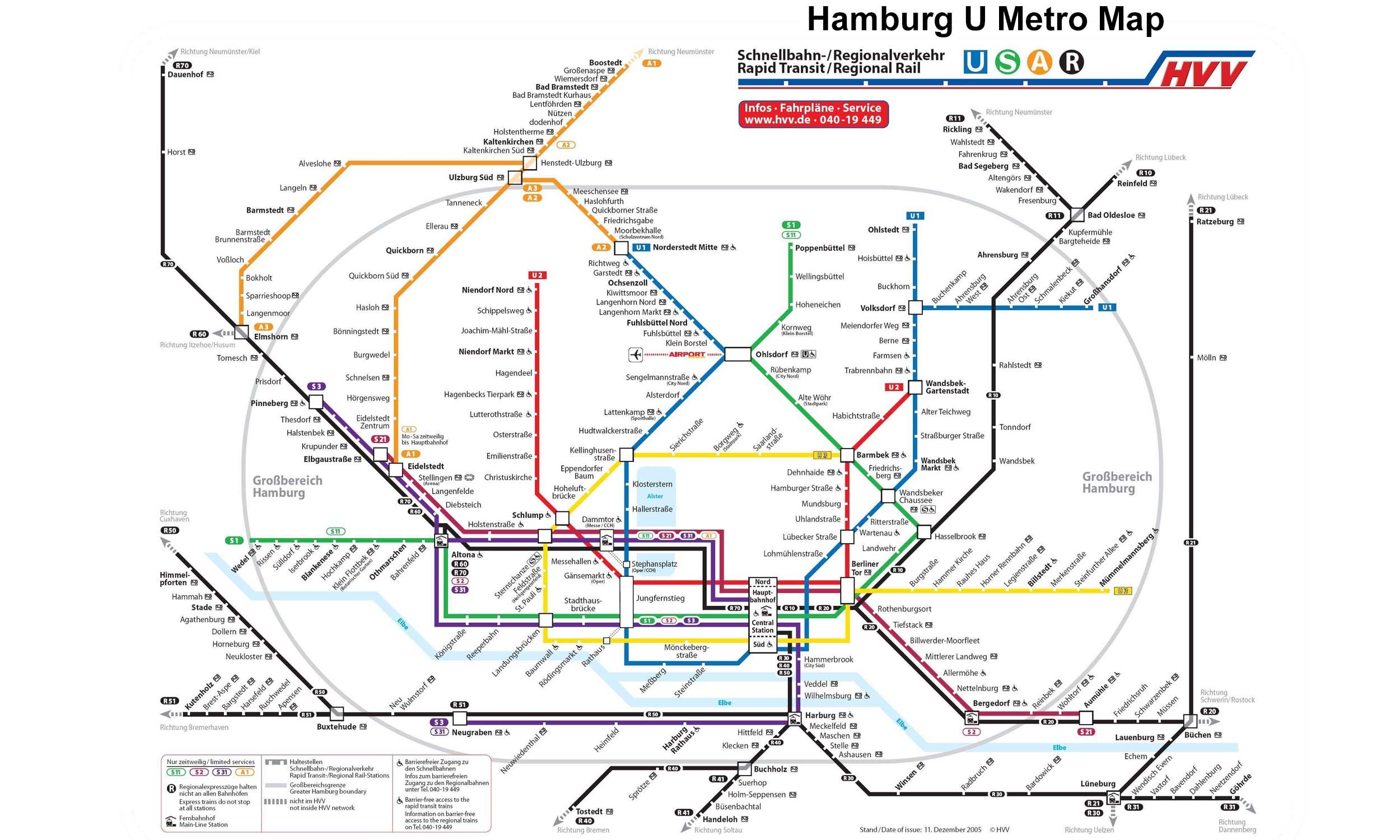
U3 Line Info
- Network Hamburg U Metro
- Total Length 20.6 km
- Total Stations 25
Terminals
From
Wandsbek-Gartenstadt
To
Saarlandstraße
U3 Line Overview
The U3 line is Hamburg's main ring metro route. Its first phase opened on 15 February 1912 as part of the city's original underground railway system between Rathaus, Hofbahnhof and Barmbek. In 2009, the network was restructured and the U3 once again became a full ring service with a branch to Wandsbek-Gartenstadt. Today, the line is approximately 20.7 km long and has 25 stations.
Hamburg U Metro Map 2026
Click to expand
Other Lines in Hamburg U Metro
Frequently Asked Questions — U3 Line
U3 Line has 25 stations on the Hamburg U Metro network.
U3 Line runs between Wandsbek-Gartenstadt and Saarlandstraße.
U3 Line is approximately 20.6 km long.
U3 Line is a Metro line operated under Hamburg U Metro.
U3 Line is part of the Hamburg U Metro transit network.