
Green Line (B) Info
- Network Boston MBTA Subway
- Operation Started 1897
- Total Length 43.0 km
- Total Stations 23
Terminals
From
Boston College
To
Government Center
Green Line (B) Overview
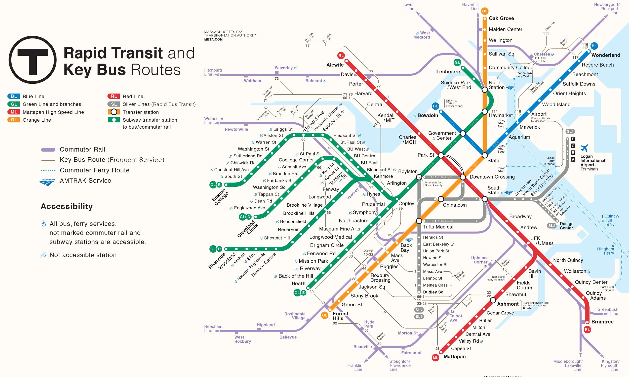
Green Line B branch opened in 1896 as part of Boston's old streetcar network and later became part of the modern Green Line system. The line runs between Government Center and Boston College, serving the neighborhoods along Commonwealth Avenue. The branch has 23 stations and provides transfers to the C, D, and E branches at Kenmore, as well as connections to other MBTA subway and commuter rail lines in Downtown Boston.
Boston MBTA Subway Map 2026
Click to expand
Other Lines in Boston MBTA Subway
Frequently Asked Questions — Green Line (B)
Green Line (B) has 23 stations on the Boston MBTA Subway network.
Green Line (B) runs between Boston College and Government Center.
Green Line (B) is approximately 43.0 km long.
Green Line (B) opened in 1897.
Green Line (B) is a Light-rail line operated under Boston MBTA Subway.
Green Line (B) is part of the Boston MBTA Subway transit network.