
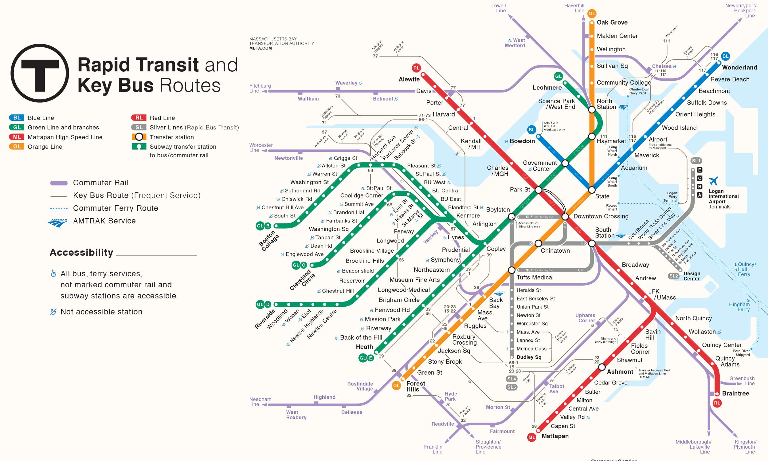
Red Line Info
- Network Boston MBTA Subway
- Operation Started 1912
- Total Length 36.2 km
- Total Stations 18
Terminals
From
Alewife
To
Braintree
Red Line Overview
As the South Shore extension of the Red Line, the Red Line Braintree Branch was constructed in phases between 1971 and 1980. This branch runs between Alewife and Braintree, providing rapid transit service to the southern suburbs. The line also offers transfers to commuter rail services at Quincy Center and Braintree, making travel between Boston and the South Shore easier.
Boston MBTA Subway Map 2026
Click to expand
Other Lines in Boston MBTA Subway
Frequently Asked Questions — Red Line
Red Line has 18 stations on the Boston MBTA Subway network.
Red Line runs between Alewife and Braintree.
Red Line is approximately 36.2 km long.
Red Line opened in 1912.
Red Line is a Metro line operated under Boston MBTA Subway.
Red Line is part of the Boston MBTA Subway transit network.