North–South Line Stations (27)
North–South Line Info
- Network Singapore MRT
- Operation Started 1987
- Total Length 45.0 km
- Total Stations 27
Terminals
From
Jurong East
North–South Line Overview
The North-South Line is a high-capacity Mass Rapid Transit (MRT) line in Singapore. Construction began in 1983, and the first phase, from Yio Chu Kang to Toa Payoh, opened on 7 November 1987. The line was expanded in several stages, and the system was completed on 4 November 1989 with the Marina Bay extension, followed by the Woodlands extension on 10 February 1996. The line covers a distance of 45 kilometres from Jurong East to Marina South Pier and has 27 stations.
Singapore MRT Map 2026
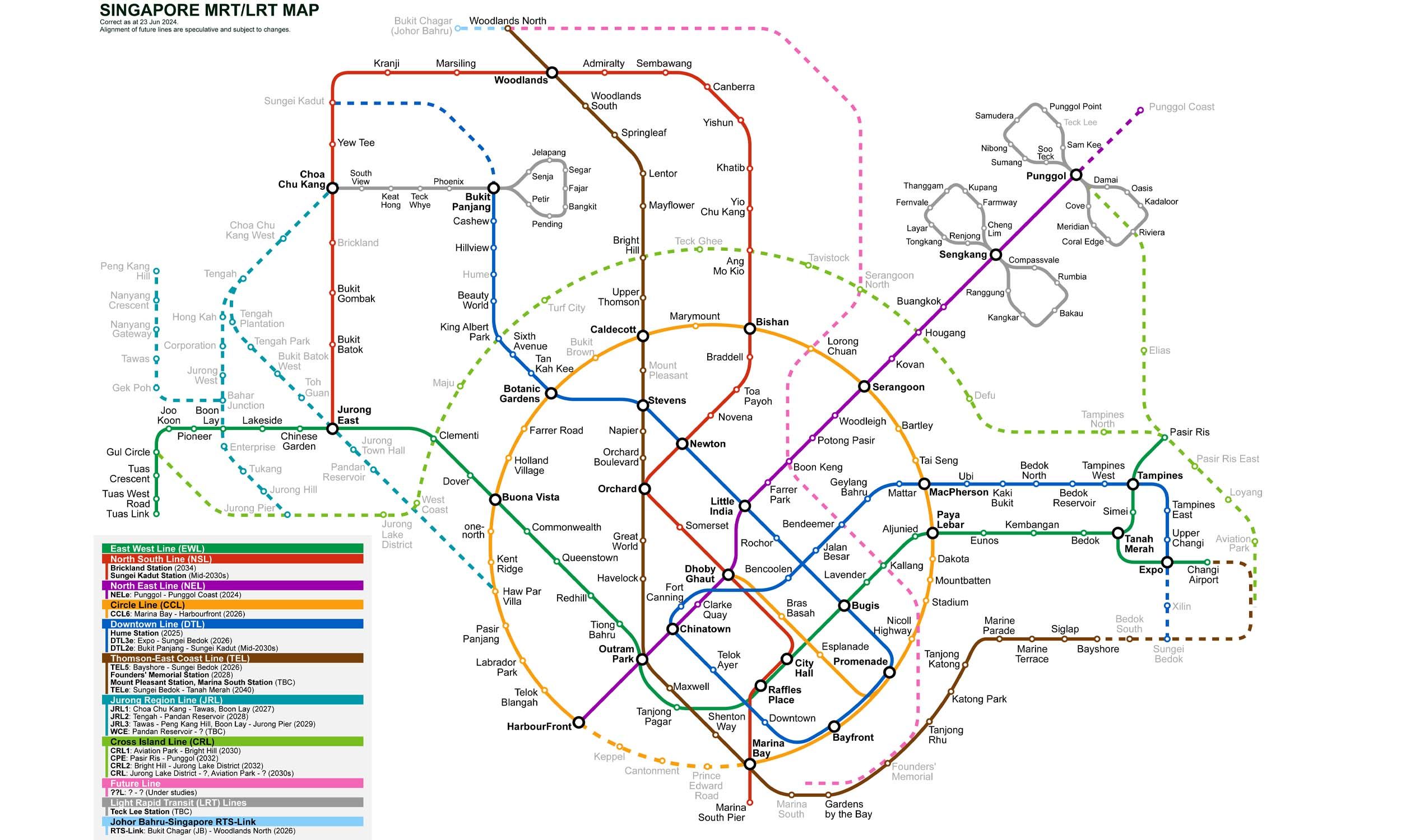
Click to expand
Other Lines in Singapore MRT
Frequently Asked Questions — North–South Line
North–South Line has 27 stations on the Singapore MRT network.
North–South Line runs between Jurong East and Marina South Pier.
North–South Line is approximately 45.0 km long.
North–South Line opened in 1987.
North–South Line is a Metro line operated under Singapore MRT.
North–South Line is part of the Singapore MRT transit network.