
Blue Line Info
- Network Washington Metro
- Operation Started 1977
- Total Length 48.8 km
- Total Stations 28
Terminals
From
Franconia–Springfield
To
Downtown Largo
Blue Line Overview
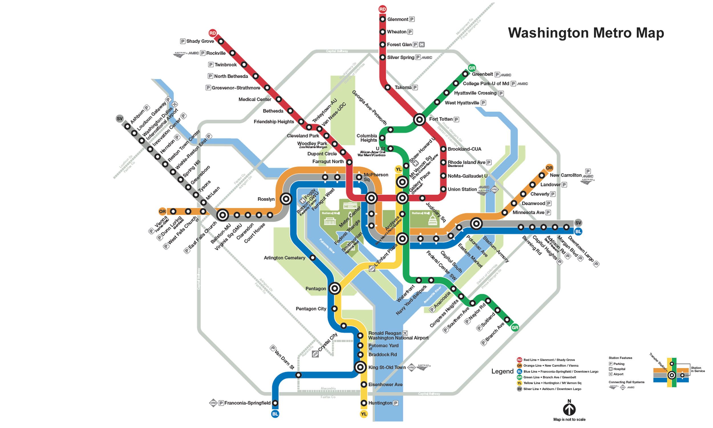
The Blue Line's first phase opened on July 1, 1977, between National Airport and Stadium-Armory, followed by extensions to Franconia-Springfield in 1997 and Largo Town Center in 2004. The line is 48.8 kilometers long and currently has 28 stations. The line also offers interchange with the Orange, Silver, Yellow, Red, Green, and Yellow Lines at transfer stations.
Washington Metro Map 2026
Click to expand
Other Lines in Washington Metro
Frequently Asked Questions — Blue Line
Blue Line has 28 stations on the Washington Metro network.
Blue Line runs between Franconia–Springfield and Downtown Largo.
Blue Line is approximately 48.8 km long.
Blue Line opened in 1977.
Blue Line is a Metro line operated under Washington Metro.
Blue Line is part of the Washington Metro transit network.