
Red Line Info
- Network Washington Metro
- Operation Started 1976
- Total Length 51.3 km
- Total Stations 27
Terminals
From
Shady Grove
To
Glenmont
Red Line Overview
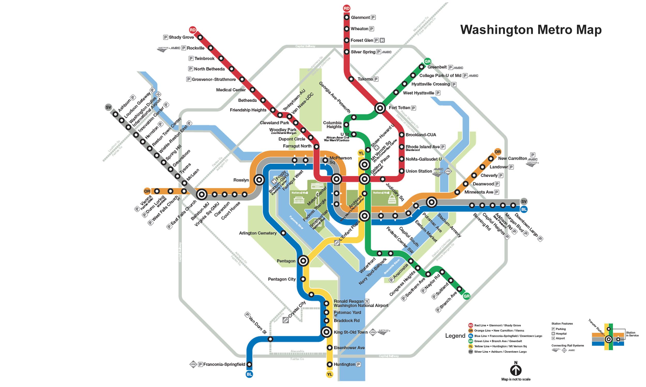
Red Line opened on March 27, 1976, as the first segment of the Washington Metro network. It is 51.3 kilometers long, between the Shady Grove and Glenmont stations, and has a total of 27 stations. The line forms a large "U"-shaped route through downtown Washington, D.C., and is the only Metro line that does not share tracks with other lines. Over the years, the line has been expanded in several phases, and the last extension to Glenmont opened in 1998. Major interchange stations include Metro Center, Gallery Place, Fort Totten, and Union Station, where passengers can connect to other Metro lines, Amtrak, MARC, and regional rail services.
Washington Metro Map 2026
Click to expand
Other Lines in Washington Metro
Frequently Asked Questions — Red Line
Red Line has 27 stations on the Washington Metro network.
Red Line runs between Shady Grove and Glenmont.
Red Line is approximately 51.3 km long.
Red Line opened in 1976.
Red Line is a Metro line operated under Washington Metro.
Red Line is part of the Washington Metro transit network.