
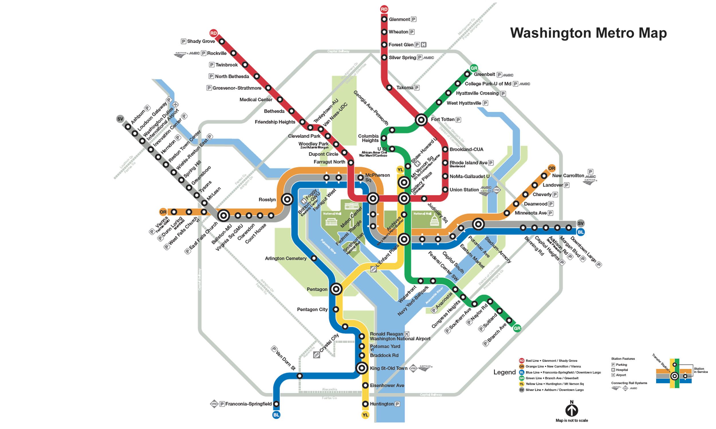
Green Line Info
- Network Washington Metro
- Operation Started 1991
- Total Length 37.1 km
- Total Stations 21
Terminals
From
Branch Avenue
To
Greenbelt
Green Line Overview
Green Line runs from Branch Avenue to Greenbelt, a distance of 37.1 kilometers, serving 21 stations. Service on the line began on May 11, 1991, and additional sections were opened in phases, with the entire route completed in 2001. The line connects Washington, D.C., to Prince George's County, Maryland, and serves several major interchange stations, including L'Enfant Plaza, Gallery Place, and Fort Totten.
Washington Metro Map 2026
Click to expand
Other Lines in Washington Metro
Frequently Asked Questions — Green Line
Green Line has 21 stations on the Washington Metro network.
Green Line runs between Branch Avenue and Greenbelt.
Green Line is approximately 37.1 km long.
Green Line opened in 1991.
Green Line is a Metro line operated under Washington Metro.
Green Line is part of the Washington Metro transit network.