
U2 Line Info
- Network Berlin U-Bahn Metro
- Operation Started 1902
- Total Length 20.7 km
- Total Stations 26
Terminals
From
Pankow
To
Ruhleben
U2 Line Overview
The first phase of the U2 line opened on February 18, 1902, between Potsdamer Platz and Stralauer Tor, as part of Berlin's original underground railway. The line was later extended in stages towards Ruhleben to the west and Pankow to the northeast. The last major extension occurred in September 2000, when the line was extended from Vinetastrasse to Pankow. Today, the U2 line is 20.7 kilometers long and has 29 stations, connecting major areas such as Alexanderplatz, Potsdamer Platz, and the Zoological Garden.
Berlin U-Bahn Metro Map 2026
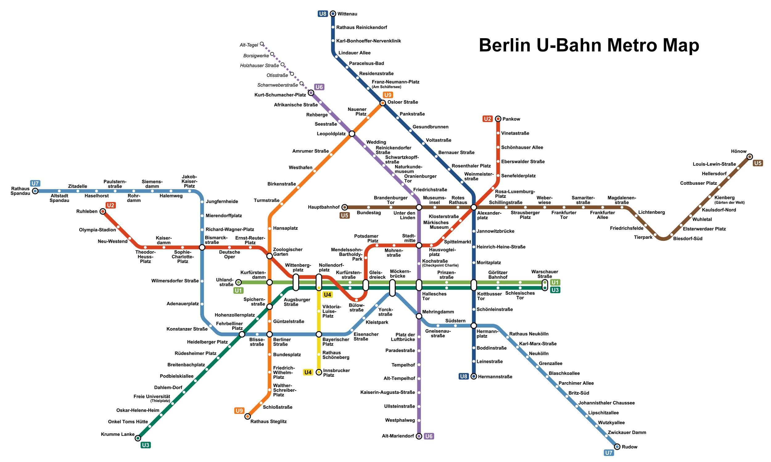
Click to expand
Other Lines in Berlin U-Bahn Metro
Frequently Asked Questions — U2 Line
U2 Line has 26 stations on the Berlin U-Bahn Metro network.
U2 Line runs between Pankow and Ruhleben.
U2 Line is approximately 20.7 km long.
U2 Line opened in 1902.
U2 Line is a Metro line operated under Berlin U-Bahn Metro.
U2 Line is part of the Berlin U-Bahn Metro transit network.