
U7 Line Info
- Network Berlin U-Bahn Metro
- Operation Started 1924
- Total Length 31.8 km
- Total Stations 35
Terminals
From
Rathaus Spandau
To
Rudow
U7 Line Overview
The first phase of the U7 line opened on April 19, 1924, between Mehringdamm and Gneisenaustrasse, as a branch of today's U6 line. The route was gradually extended southward toward Neukölln and Rudow, while a western extension reached Spandau in several stages in the 1960, 1970, and 1980. The final extension from Rohrdamm to Rathaus Spandau opened on October 1, 1984. The U7 line is the longest line in the Berlin U-Bahn network, stretching 31.8 kilometers between Rathaus Spandau and Rudow and serving 40 stations.
Berlin U-Bahn Metro Map 2026
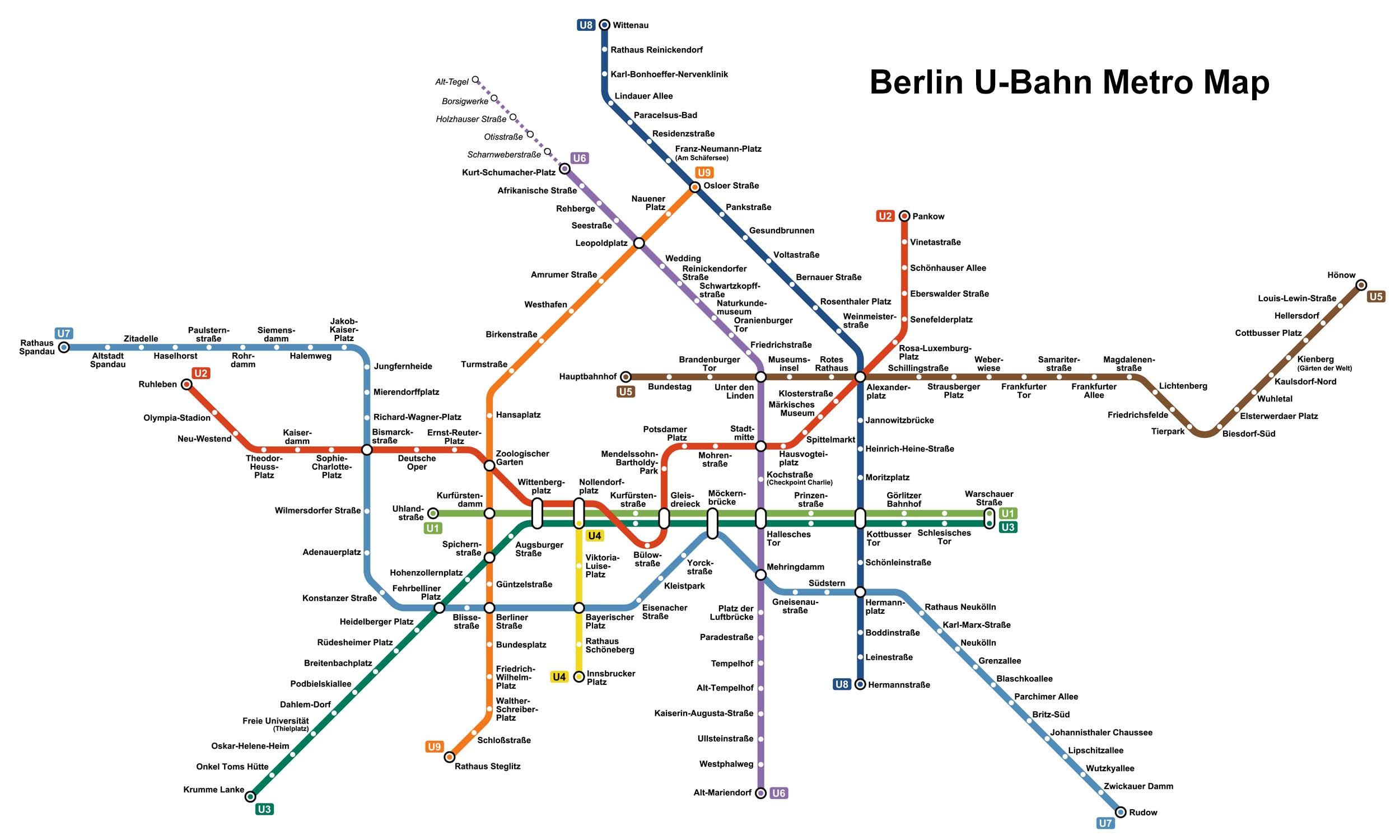
Click to expand
Other Lines in Berlin U-Bahn Metro
Frequently Asked Questions — U7 Line
U7 Line has 35 stations on the Berlin U-Bahn Metro network.
U7 Line runs between Rathaus Spandau and Rudow.
U7 Line is approximately 31.8 km long.
U7 Line opened in 1924.
U7 Line is a Metro line operated under Berlin U-Bahn Metro.
U7 Line is part of the Berlin U-Bahn Metro transit network.